NavList:
A Community Devoted to the Preservation and Practice of Celestial Navigation and Other Methods of Traditional Wayfinding
From: David Pike
Date: 2014 Dec 19, 13:45 -0800
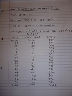
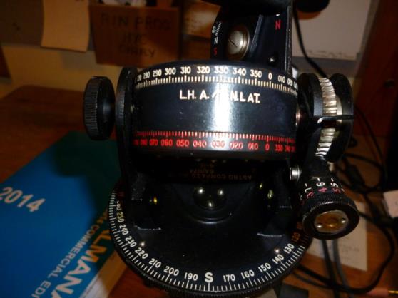
Marty. You don’t need to use Excel. That would involve knowing how to format cells in hours and minutes and degrees and minutes which in my case would involve finding someone who was still in nappies when I was doing the stuff in the air to explain it to me. All you need to know is two things. LHA Sun = GHA Sun – your Longitude W, and that the sun goes around the earth at 1 degree of longitude every four minutes. First you need to find GHA Sun for your start time. Any of the sites giving almanac details will do. I used https://navsoft.com/2014_Nautical_Almanac.pdf . I bet it’s even available on this site. I worked a set of values out from 10.00 to 11.00 UTC tomorrow. This will also be my local time. My position is 53.10N 001.32W. GHA Sun is 330d 37.5’, so LHA Sun is 329d 05.5. Now if your using something like the ubiquitous Air Ministry Astro Compass MkII used by the RAF and RCAF, you can’t set LHA to better than one degree, so call it 329 degrees. Then draw your table. Just keep adding four minutes to the time and one degree to the LHA. You also need to fill in your local times. Of course it starts to wobble after a day or so, but who wants to play with an astro compass for that long.


