Welcome to the NavList Message Boards.

NavList:

A Community Devoted to the Preservation and Practice of Celestial Navigation and Other Methods of Traditional Wayfinding

Compose Your Message

Message:αβγ
Message:abc
Add Images & Files
    Name or NavList Code:
    Email:
       
    Reply
    Latitude 48 Article Image as CN Piloting Exercise
    From: Greg Rudzinski
    Date: 2020 Aug 23, 05:22 -0700

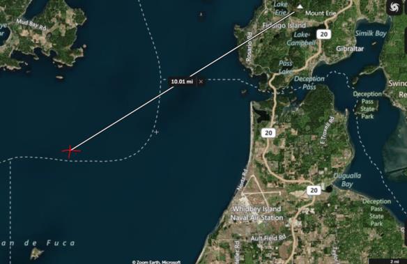
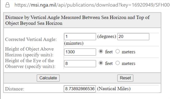
    David Burch forwarded a Latitude 48 article that had a cool image of the moon and venus showing nicely off the starboard bow of one of the racing sailboats. David suspected that this image was a morning twilight capture on 16 August 2020 in the general area of Smith Island (48.3° north 122.8° west). The caption under the photo refers to sunset. I am in agreement with David on this and have performed a CN piloting exercise using the moon azimuth and a moon diameter as angular reference. The best match for the mountain is Mount Erie at 1300 ft. The range by vertical angle  and azimuth relative to the moon is consistent with date and position on the last leg of the reported sailboat race.

    https://48north.com/racing/race-reports/even-unfinished-northern-century-delivers/

    Greg Rudzinski
    File:


    File:


    Reply
    Browse Files

    Drop Files

    NavList

    What is NavList?

    Get a NavList ID Code

    Name:
    (please, no nicknames or handles)
    Email:
    Do you want to receive all group messages by email?
    Yes No

    A NavList ID Code guarantees your identity in NavList posts and allows faster posting of messages.

    Retrieve a NavList ID Code

    Enter the email address associated with your NavList messages. Your NavList code will be emailed to you immediately.
    Email:

    Email Settings

    NavList ID Code:

    Custom Index

    Subject:
    Author:
    Start date: (yyyymm dd)
    End date: (yyyymm dd)

    Visit this site
    Visit this site
    Visit this site
    Visit this site
    Visit this site
    Visit this site