NavList:
A Community Devoted to the Preservation and Practice of Celestial Navigation and Other Methods of Traditional Wayfinding



From: Linda Mestas
Date: 2026 Aug 6, 12:31 -0700
Thank you for the invitation. You're right: this is the best celestial navigation group I have seen anywhere.
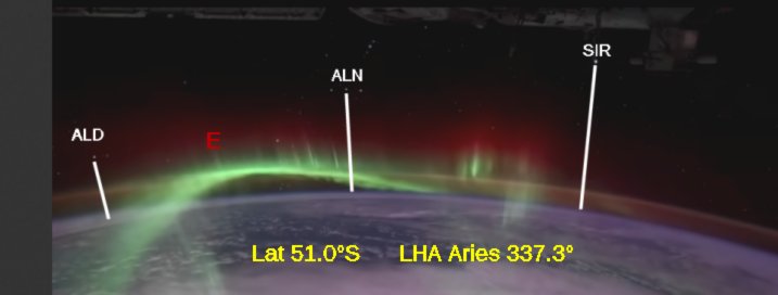
Such an unusual space station navigation problem... Mind-blowing! But I think I have a good estimate based on your third image.
Latitude below the space station 51.0°S with LHA Aries 337.3°. I believe these to the nearest half degree. I am happy to see that the maximum southern latitude for the space station would be 51.6°. I think LHA Aries is determined by what we see, but without the date and UTC the longitude could be nearly anywhere. I will guess South Pacific.
Details: I found three navigation stars in that image: Aldebaran far left, Alnilam in the belt, and Sirius toward the right. I used the length of the belt as a scale to get three altitudes. Then I subtracted dip for 250 miles altitude. That gives some very negative observed altitudes! That's exciting. Then I simulated in Stellarium, turning on the azm/alt grid and turning off the ground and atmosphere.