NavList:
A Community Devoted to the Preservation and Practice of Celestial Navigation and Other Methods of Traditional Wayfinding
From: Peter Hakel
Date: 2017 Mar 2, 15:21 -0800
Frank,
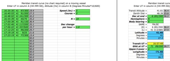
From the "transit" spreadsheet I compute your location as:
N 41° 27.4’
W 71° 26.7’
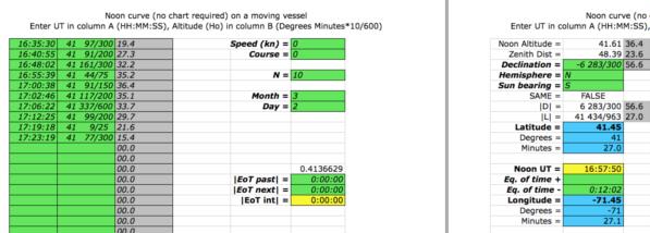
From the "noon_motion" spreadsheet I compute your location as:
N 41° 27.0’
W 71° 27.1’
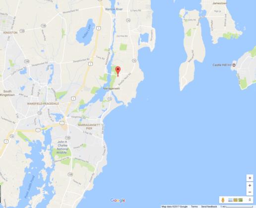
Screenshots are attached; the Google maps location is for the “transit” coordinates (not quite on the beach, but note the distance scale in the lower right corner). The two spreadsheets differ as follows:
*) “noon_motion” (being specific to the Sun) calculates the UT of the culmination and shifts the resulting longitude according to the equation-of-time value; also the hourly declination change is calculated only approximately from the month and day,
*) “transit” (applicable to any celestial body), picks up the longitude from the user-entered GHA for the UT of the culmination; the hourly declination change is “exact” as input by the user.
The parabolic fit computed internally by both spreadsheets works with observed altitudes that are prorated by the declination change and vessel motion to the moment of the last observation.
Peter Hakel


