NavList:
A Community Devoted to the Preservation and Practice of Celestial Navigation and Other Methods of Traditional Wayfinding
From: Bill Ritchie
Date: 2017 Mar 7, 21:35 +1300
Based only on the information you gave, Frank, I have two solutions.
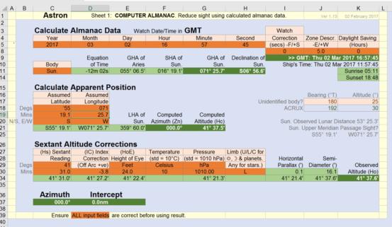
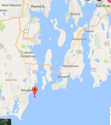
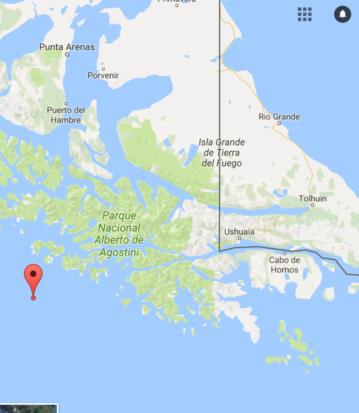
One near Cape Horn (S55° 19.1 W071° 25.7’) and the other South West of Newport (N41° 25.8’ W071° 25.7’). The Moon and Venus were visible at both locations. You say the weather was chilly and blustery with great waves, so perhaps the Southern hemisphere location fits the bill best!
As several others have suggested various curve fit methods of obtaining meridian passage time and maximum altitude from your sights, I tried a different approach, using outer pairs of sights as ‘pointers’.
A rough graph indicated passage around 16:58. I modified the altitudes (at 0.1’ per 6 minutes) to what they would have been with an imaginary sun of fixed declination at 16:58. Then interpolated sights 1 & 2 and 8 & 9 to obtain the times at a common altitude, the median of these being my suggestion for the meridian passage time (16:57:45). Although linear interpolation is wrong, the errors should cancel as the modified graph is symmetrical. My estimate of maximum altitude from the graph is 41° 31.0’. This gives the above positions.
|
|
Time |
Alt |
Mod Alt |
Time at 41° 17.0’ |
|
1 |
16:35:30 |
41° 13.0' |
41° 13.4’ |
16:38:00 |
|
2 |
16:40:55 |
41° 20.9' |
41° 21.2’ |
|
|
|
16:48:02 |
41° 25.8' |
|
|
|
|
16:55:39 |
41° 28.8' |
|
|
|
|
17:00:38 |
41° 30.0' |
|
|
|
|
17:02:46 |
41° 28.7' |
|
|
|
|
17:06:22 |
41° 27.3' |
|
|
|
8 |
17:12:25 |
41° 23.3' |
41° 23.05' |
17:17:30. |
|
9 |
17:19:18 |
41° 15.2' |
41° 14.85’ |
|
|
|
17:23:19 |
41° 09.0' |
|
|
Bill Ritchie


