NavList:
A Community Devoted to the Preservation and Practice of Celestial Navigation and Other Methods of Traditional Wayfinding
From: Bill Ritchie
Date: 2017 Mar 11, 17:43 +1300
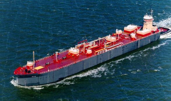
Sean, you made me look at Greg’s photographs closely. I thought the vessel was a laden tanker, but is it not the barge RTC 145 with attendant tug Christian Reinauer pushing at the stern? If so, at present (1700 on 11th March New Zealand Time) she is berthed at Sewaren, New Jersey which (unless she can do over 40 knots) rules out my Cape Horn alternative position! But wait, she appears to be carrying deck cargo just forward of the crane – or is that a distant island?
Bill Ritchie
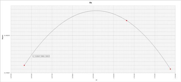
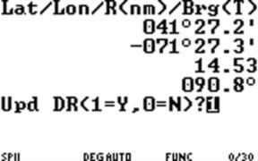
I thought I'd give it a go while we're waiting for the answer. I put the middle three altitudes into excel seeing as how the 4th and 6th were almost equal. I then enabled a polynomial trendline and arrived at a LAN time of 16:59:09 and a max altitude of 41°30.3'. I used these as a starting point and input the resulting lat/lon into StarPilot-89 (which I had received as a Christmas gift from my wife). So, starting with a "DR" of 41°27.4' N, 71°46.7' W, I asked StarPilot for a fix by computation. The result was 41°27.2' N, 71°27.3' W. Next, I used the "Sight Analyzer" at the given fix to see how the curve fit.
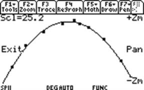
StarPilot's sight analyzer works by calculating the Hc for each time at the fix and subtracting out the corrections to arrive at "Hs'". It then plots a curve (or slope) corresponding to the motion the body should have been exhibiting at the given times and location. The user can then slide the curve up or down to account for random/systematic error and find the best fit. The method is a lot like the one described by David Burch in his paper at the Starpath website. Anyway, the curve looked pretty good right off the bat. So I am going with StarPilot's calculation of 41°27.2' N, 71°27.3' W. The intercepts at this location are 0.0', +0.9', -0.5', -0.6', +0.6', -0.2', -0.1', +0.4', +0.2' and 0.0' respectively. (µ = 0.07', σ = 0.4') See attached screen shots.
[Actually, taking Frank's pictures into account, I would say a longitude of 71°23.7' W is more likely. But, I think that's kind of cheating, so I'll go with the previous location.]
Cheers,
Sean C.
Attached File:
Attached File:
Attached File:


