NavList:
A Community Devoted to the Preservation and Practice of Celestial Navigation and Other Methods of Traditional Wayfinding
From: David Pike
Date: 2021 Dec 22, 03:54 -0800
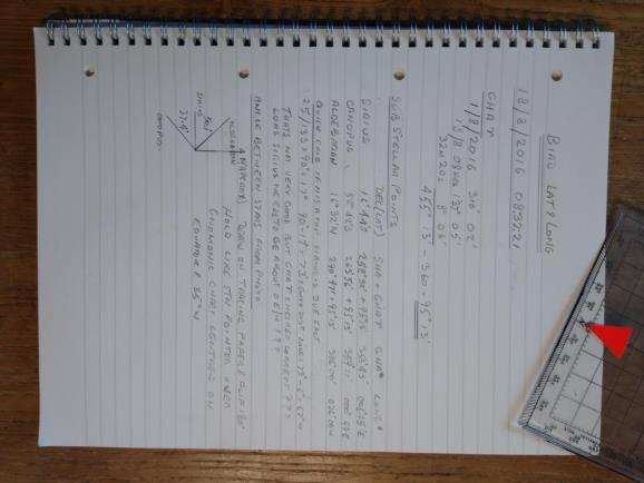
This is your chance to share the Nobel Prize for Astro for 2021. Please will one of you map experts check and finish this for me. We used to score H2S radar photos by matching lines drawn on tracing paper from the centre of a photograph of the H2S screen though three radar significant features (preferably 120 degrees apart) and matching the lines against the same features on a 63K OS map like using a station pointer. I know we tell beginners astro fixes based upon a zenith distance and an azimuth are impractable, but I thought map matching might be worth a try. I’ve worked out the sub-stellar points for Sirius, Canopus, and Aldebaran for the date and time in question, found the centre of the dome, and measured the angle between the stars. North might on might not be exactly at the top of the photo, but Sirius lies approximately east. What I’d like someone to do is find/produce a gnomonic chart based upon the equator and showing South America. Ideally the chart should be based upon 15S 35W if you’ve the facility. Plot the sub-stellar points on the gnomonic chart and draw the angle between the stars on tracing paper (or use a station pointer). Flip it over; line it up best fit though the sub-stellar points; and see where you end up. Thanks, DaveP


