NavList:
A Community Devoted to the Preservation and Practice of Celestial Navigation and Other Methods of Traditional Wayfinding
From: Frank Reed
Date: 2017 May 12, 10:44 -0700
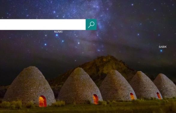
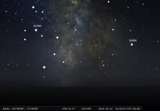
We can actually use two of the traditional navigation stars to solve your puzzle. The stars Nunki and Sabik are minor, fainter stars, but they're among the 57 considered as "official" navigation stars since the mid-1950s. They're both in the photo you posted. To get latitude from them, we can compare their altitudes relative to the horizon, or we can look at the "tilt" of a line passing through them relative to the horizon. In either case, we need to estimate where the horizon is in the photo, which can only be done approximately. That's the limiting factor in this process. You can experiment with sky simulation software, like Stellarium, until the locations of those stars, and for that matter all the others around them match generally with their appearance in the photo. This yields a latitude not so different from my own latitude: about 41° or 42° North. Below is a comparison of the image you posted and a sample simulation in Stellarium. Ignore the longitude and figure +/- 1° on the latitude.
Frank Reed


