NavList:
A Community Devoted to the Preservation and Practice of Celestial Navigation and Other Methods of Traditional Wayfinding
From: Modris Fersters
Date: 2020 Dec 13, 18:48 -0800
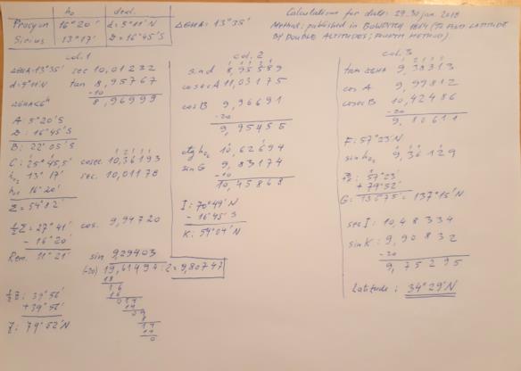
In the NavList archive (Dec 2017; Janv 2018) I found interesting exercise: party boat puzzle (author: Frank Reed). I tried to solve latitude problem, using 19 century Bowditch. It was very exciting. All process on paper only, and two altitudes (Sirius and Procyon) gave me latitude 34°29' N. It was only 0,7' from value precisely calculated by Antoine Couette (his result was 34°29,7' N).
I used step by step guidelines published in Bowditch(year 1864) and table XXVII (in the same book). I used pdf format e-book.
I could not imagine that whole process will be so time consuming. For example, I can clear lunars using 19. century Thomson tables in some 7…9 minutes, but this unexpectedly took 5…6 times more time. It was surprise for me, because all the calculations fits in one A4 format page. Visually it seems that the procedure is not so complicated. Of course I understand that for those 19 century navigators who did these calculations regulary, the task was ordinary. However, I doubt how frequently the method of latitude by two altitudes was used at that time.
Here is my calculation sheet.


