NavList:
A Community Devoted to the Preservation and Practice of Celestial Navigation and Other Methods of Traditional Wayfinding
Re: The Length of a Day
From: Stan K
Date: 2016 May 27, 09:48 -0400
From: Stan K
Date: 2016 May 27, 09:48 -0400
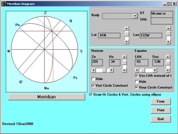
For those of you who like to play with meridian diagrams, there are three programs available from the Power Squadrons web site that do this.
1) Navtra lets you enter any three of the parameters (latitude, local hour angle, declnation, altitude, azimuth) and solves for the other two, giving the two possible answers when that is the case. It then draws the meridian diagram for the selected case.
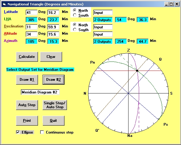
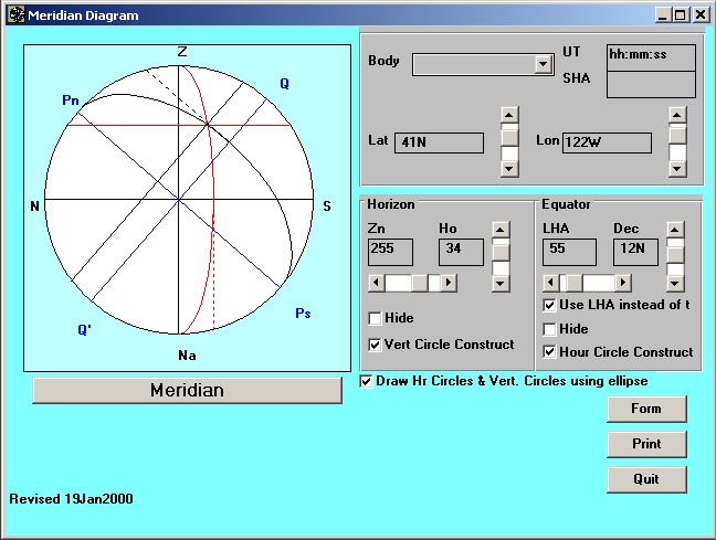
2) Plottool lets you adjust any of the parameters (whole degrees by sliders, tenths of a degree if entered directly) and draws a meridian diagram.
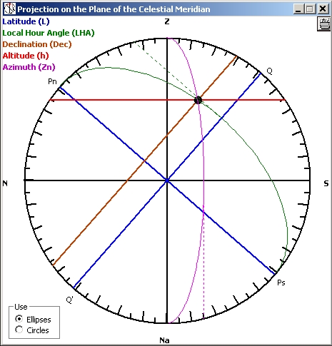
3) Celestial Tools draws the meridian diagram for any sight reduced by Celestial Tools.
Each program has various options.
Examples:
Let me know if there is any interest in any of these programs.
Stan
-----Original Message-----
From: Sean C <NoReply_SeanC@navlist.net>
To: slk1000 <slk1000@aol.com>
Sent: Fri, May 27, 2016 8:39 am
Subject: [NavList] Re: The Length of a Day
Attached File:

From: Sean C <NoReply_SeanC@navlist.net>
To: slk1000 <slk1000@aol.com>
Sent: Fri, May 27, 2016 8:39 am
Subject: [NavList] Re: The Length of a Day
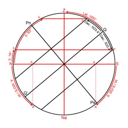
Another way of illustrating the length of a day at various times throughout the year is my personal favorite...the diagram on the plane of the meridian. In the attached sample, set at 50° north latitude, one can see from the portion of black 'declination lines' which is above the red 'N-S' line (the horizon) how the amount of time the sun is above the horizon changes with declination. As an added bonus, one can see how the azimuth of the rising/setting sun changes and the difference in culmination altitudes.
-Sean C.
Attached File:


