NavList:
A Community Devoted to the Preservation and Practice of Celestial Navigation and Other Methods of Traditional Wayfinding
From: David C
Date: 2020 Apr 28, 20:26 -0700
On Tuesday morning the stars, the sun and venus fell into alignment. Well, figuratively anyway. The sky was blue and there was very little wind. It was the first day of slightly reduced lockdown restrictions so we were no longer restricted to our local area. Also takeaways were permitted to open for business provided they had contactless trading. Then I saw Michael's post and thought why not!
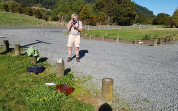
First we went to our favourite takeaway (NOT Maccas or KFC, but a locally owned healthy food outfit which we support) and learned the new purchase procedures such as standing outside the shop and phoning through the order. Then we headed a few km out of town - the first time for five weeks - to a suitable site for CN. As the crow flies it was 6km from Rivendell (LOTR). The latter was only 10 minutes or so drive away but the new lockdown rules were a little unclear so we decided not to proceeed any further.
I forgot to copy the relevant page from the almanac and copy the Ogura and Aquino worksheets so working the sights had to wait until we got home.
Here is what I did:
I took several sights about 11am local time.
I selected one sight.
23 16 04 2020/4/27 UT h = 65° 28.5'
GHA 169° 38.2'
Dec 14° 13' N
GNSS 41° 05.1' S
175° 08.5' E
Hs 65° 28.5'
IE 4' on
SD/Refraction +14.8' from 1973 Nautical Almanac
Ho 32° 57'
I determined the LOP by five methods:
(a) Assume longitude a whole degree. Use cos formula.
41° 00' S 175° 00' E
t = 15° 21.8'
Hc 32° 58.7'
Intercept 1.7' away
(b) GNSS position. Use cos formula.
t= 15° 13.3'
Hc 32° 55.8'
Intercept 1.2' to
dep 6.4' The departure relative to 175° fo plotting on a plain chart.
(c) Rivendell position. Use cos formula.
From google earth position is 41° 3.3' S 175° 11.7' E
t = 15° 10.1'
Hc 32° 58.2'
Intercept 1.2' away
dep 8.8'
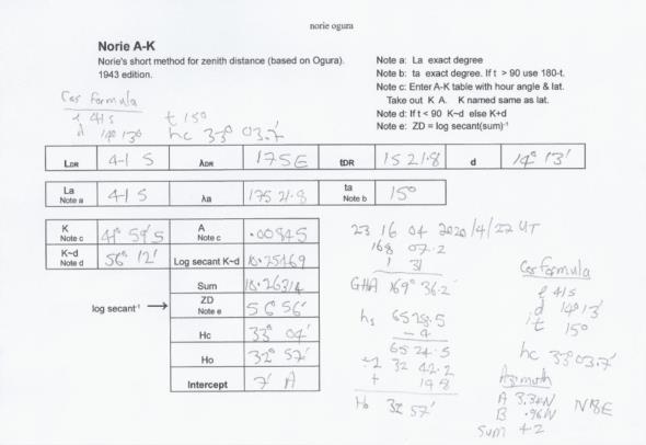
(d) Assumed hour angle a whole degree. Use Ogura (Norie A_K) tables.
41° 00' S 175° 21.8' E
t = 15°
Hc 33° 04'
Intercept 7' away
dep 16.5'
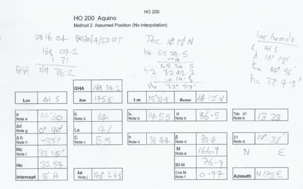
(e) Aquino tables (HO200) - assumed hour angle deternined by tables.
41° 00' S 175° 26.8' E
t = 14° 55' This value determined by the tables.
Hc 33° 05'
Intercept 8' away
Azimuth N 17.5 E
dep 20.2'
Azimuth
Aquino was the only method that gave the azimuth. For practical navigation all azimuths will be the same so I computed it by Norie's ABC tables.
A 3.34 N
B .96 N
Sum 4.2
From table C azimuth = N 18° E
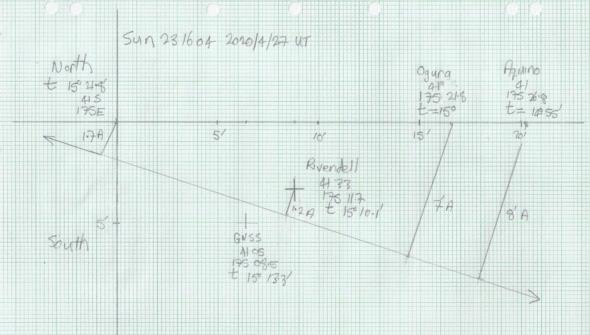
Plot
I plotted the LOPs on a plain chart. After a lot of frustrating effort correcting errors I finally got the five LOPs to merge into one!


