NavList:
A Community Devoted to the Preservation and Practice of Celestial Navigation and Other Methods of Traditional Wayfinding
Re: Longhand Sight Reduction
From: Hanno Ix
Date: 2014 Nov 9, 12:51 -0800
From: Hanno Ix
Date: 2014 Nov 9, 12:51 -0800
Greg,
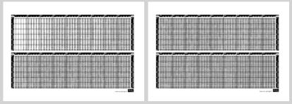
may I offer you a haversine table with a higher resolution? Of course, it is meant particularly for those who wish to use the haversine - Doniol I recently proposed. Please see attachment.
I have chosen a step size of 2 arc min which compacts the table significantly.
The difference of haversine(x) per 2' of x never exceeds 3 units of the 4th digit. So, a mental interpretation is very easy - no interpolation tables or written calculations needed. I consider this the biggest advantage of this table's format.
The font used is about the same size as the ones on my slide rulers. The margins are still big enough for lots of annotation, for instance dip, refraction and a work area just as you proposed. If somebody would like to have additional annotation or just a taller font - there is plenty of space left. Of course, visual guides for the ease of looking up are included, too.
For my purposes I will also include a Vedic multiplication workspace. I favor it simply because I make rarely mistakes and arrive at the result must faster.
I invite you to test-drive this table, too!
H
On Sat, Nov 8, 2014 at 6:31 PM, Greg Rudzinski <NoReply_Rudzinski@navlist.net> wrote:
Francis,
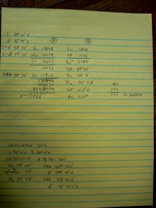
Here is an example from this afternoon for you.
L= Latitude
d= Declination
LHA= Local Hour Angle or Meridian Angle
P= Product
hv= Haversine
hv(-1)= Arc Haversine
ZD= Zenith Distance
Hc= Calculated Altitude= (90°-ZD)
Reduction sequence for latitude and declination contrary in name:
Column A: hv(L+d) + hv(L-d)= sum. (1-sum) x hv(LHA)= P
Column B: hv(L+d) + P = sum. Arc hv(sum)= ZD. 90°-ZD= Hc
Greg Rudzinski
Attached File:
(Doniol-Haversine_.jpg: Open and save)


