NavList:
A Community Devoted to the Preservation and Practice of Celestial Navigation and Other Methods of Traditional Wayfinding
From: Frank Reed
Date: 2019 Aug 24, 15:44 -0700
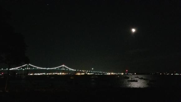
Last night (early hours of August 24 by Greenwich Time) I took this photo looking northeast towards Newport, Rhode Island. That's the Pell-Newport Bridge. You can make out the "pentagon" of bright stars in Auriga with Capella high above the center of the bridge. The Moon is over-exposed. Aldebaran is just below it. At the time of the photo, the azimuth of Aldebaran was about 5-7 minutes of arc to the left of the Moon's center. Can you determine UT? How about latitude? Local time?
Some suggested steps:
- Get an angular scale by measuring pixels in the image and comparing with known angular distances between the stars in Auriga.
- Get latitude from the relative altitudes of Capella and Aldebaran.
- Get local time from the altitude of any star, maybe the southernmost in Auriga.
- Get UT from the relative azimuth of the Moon and Aldebaran.
Which of these determinations is accurate? Which are not? If you had to put error boxes around your latitude and longitude, would they at least contain the observer's location?
You might think that this is all just a pointless game, but this sort of technique for testing astronomical details in photographs is essential for fact-checking photos of real-world events. Many photos are spoofed, but few digital artists bother to get the astronomical details right. And of course, it's a good test of our understanding of underlying navigation concepts.
Frank Reed


