NavList:
A Community Devoted to the Preservation and Practice of Celestial Navigation and Other Methods of Traditional Wayfinding
From: Ed Popko
Date: 2018 May 15, 17:21 -0700
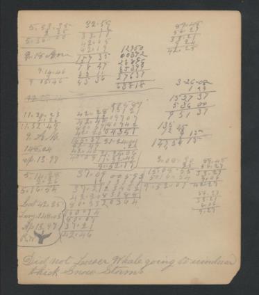
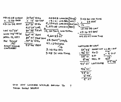
I made a first pass on the third (bottom) set of calculations. There appears to be two distinct reductions, a time-sight for longitude (mid section) and a meridian passage LAN for latitude (far right).
The general time-sight method is the same as the Elizabeth case. There were no surprises.
The latitude by meridian passage method was simple enough with zenith distance and sun's declinations. It seems they used a shortcut for zenith distance. Instead of using 90°, they used 89°48' which suggests they combined lower limb correction and dip all in one.
The latitude computation is followed by some additional calculations I can't quite figure out. I'm also not use I'm reading the units right.
It seems they bagged a Right Whale (RW?) that day.
Snow storm on April 13th?
Can't read the full text at the bottom but it goes something like this: "Did not locker whale going to ?? thick snow storm."
Ed Popko


