NavList:
A Community Devoted to the Preservation and Practice of Celestial Navigation and Other Methods of Traditional Wayfinding
From: Frank Reed
Date: 2018 May 16, 14:22 -0700
Ed, you wrote:
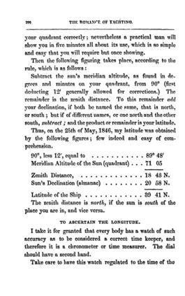
"It seems they used a shortcut for zenith distance. Instead of using 90°, they used 89°48' which suggests they combined lower limb correction and dip all in one."
Yes. As I'm sure you recall from my workshop (now known as "Celestial Navigation in the Age of Sail"), that's what I call the navigator's right angle. It's a quick and easy solution when you're on a small ocean-going vessel (or what would have been counted as a typical ocean-going vessel 200 years ago). And it's a special case of the +12/-20 rule. The origin of it is simple enough: if you're going to add 12' to every measured sun sight (technically only Lower Limb sights, but Upper Limb Sun sights are basically a game played by modern navigation teachers and students --and no one else), and then subtract that from 90°, then it's quicker to subtract the altitudes directly from 89°48'. I use this on a regularly for quick meridian altitude work today. There's nothing wrong with it, assuming your height of eye is in the range of about 7 to 20 feet and assuming the Sun is above about 30° so that refraction is not more than a minute of arc.
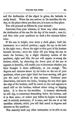
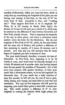
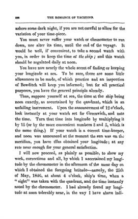
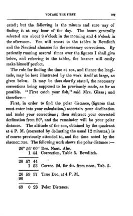
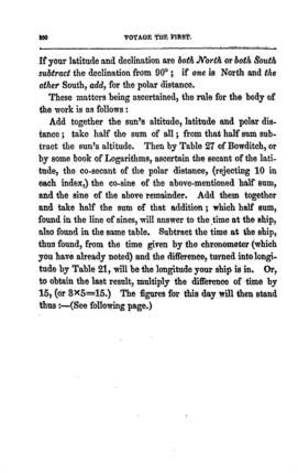
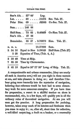
I've mentioned a funny little blog-like book from 1848 called the "Romance of Yachting", when yachting meant something more like "cruising" today. if you read this seven-page extract from it, you'll see how standardized and familiar "nautical astronomy" was in this era. Everything you find in the "Elizabeth pages" is spelled out here, and it's all quite simple. This is how it was done back then. just the straight-forward application of a set of rote algorithms. Navigators were human spreadsheets when working their sights.
Frank Reed
