NavList:
A Community Devoted to the Preservation and Practice of Celestial Navigation and Other Methods of Traditional Wayfinding
From: David C
Date: 2020 Jul 5, 20:14 -0700
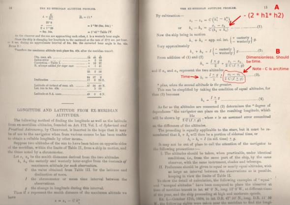
Ex-Meridian Altitude Tables by Charles Brent RN (1923) includes a chapter called Longitude and Latitude from Ex-Meridan Altitudes. The longitude determination involves taking a sight before noon and another after noon. Unlike the Equal Altitudes method the two altitudes do not have to be equal. Yesterday I used this method and determined that my noon longitude was 5.2' west of the GNSS value.
I am finding it difficult to understand the process, See the attached image. In A I have used (h1+h2)(h1-h2) = h12 + h22 - 2*h1*h2 to derive equation 1. h1 and h2 are approximately equal so 2*h1* h2 is of the same order as h12 and cannot be ignored - but it has. Why?
In B the correction factor is dimensionless but should have dimensions of time.
Any comments? What am I doing wrong? Note that I have ignored the factor g because the Pacific plate is moving at only 10cm per year!


