NavList:
A Community Devoted to the Preservation and Practice of Celestial Navigation and Other Methods of Traditional Wayfinding
From: Frank Reed
Date: 2024 May 15, 14:50 -0700
My Lunars workshop is happening again soon, June 1-2 at Mystic Seaport Museum in Mystic, Connecticut. I've been describing lunars for a few days in emails and interviews, and some of this adds up to a decent, basic NavList post.
What's a "lunar" anyway? The goal of lunars historically was to determine absolute time, realized as GMT or maybe Paris Mean Time or in the modern world UT. The Moon's motion against the stars and planets and relative to the Sun on the celestial sphere is like a great slowly-moving hour hand tracing a path once around the dial every month.
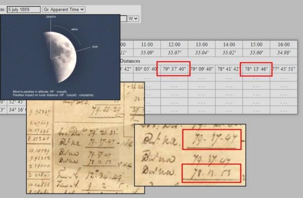
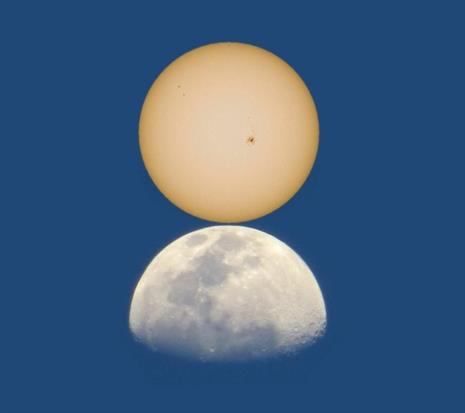
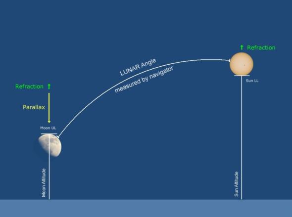
The entire observation typically requires three sights. You measure the angle between the Sun and Moon's limbs, edge-to-edge, so they just make contact. That angle is what was meant by a "lunar distance" historically. You also measure, at about the same time (you have some leeway here), the altitudes of the Sun and Moon. These altitudes are not used the way altitudes are commonly used in celestial navigation. Many navigators with a background in modern or traditional celestial navigation are surprised by this. The two altitudes are not for a position fix, and, for a contrast, there would be no problem at all if the two bodies were on exactly the same or exactly opposite azimuths --which would be very bad if we were using the altitudes for a position fix. Instead the primary purpose of the altitudes is to determine the unique altitude corrections for the Sun and Moon which feed back to give the all-important correction to the observed "lunar distance" angle. The values of the refraction and parallax corrections as well as the fractional portion of those corrections that impact the lunar distance are determined by the altitudes of the two bodies. This process of correcting the observed lunar distance based on corrections derived from the altitudes was known historically as "clearing a lunar distance".
After the lunar angle has been cleared or corrected, it is effectively a geocentric angle, and that angle would be compared with a list in the old nautical almanacs or similar modern tools providing the predicted geocentric lunar distances at regular intervals of GMT/UT, typically every three hours in historical almanacs. The rest is an easy interpolation, and you get your actual GMT (UT) as your output. The Moon moves relative to the Sun and other celestial bodies at a rate of about half a degree in one hour, equivalent to half a minute of arc in one minute of time, or (as good as it gets) a tenth of a minute of arc in about twelve seconds of time. The whole process turns the Moon into a "chronometer in the sky", and once you have that Moon-based GMT, you can continue and use it just as if you have a functioning mechanical or digital chronometer.
This process is what's meant by "shooting a Lunar". It was very popular with long-distance navigators in the last third of the 18th century and the first half of the 19th century (1767-c.1850) with some experiments and semi-practical application in earlier years and minor, fading use in decades after 1850. But if you look hard enough, you can find someone shooting lunars for some purpose that is at least slightly practical in almost every decade right through the present day.
Frank Reed
Clockwork Mapping / ReedNavigation.com
Conanicut Island USA


