NavList:
A Community Devoted to the Preservation and Practice of Celestial Navigation and Other Methods of Traditional Wayfinding
From: Greg Rudzinski
Date: 2015 Jun 27, 20:04 -0700
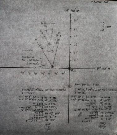
Good pick-up Peter. The plotting sheet is mislabelled. It should read 34° 20' N for Latitude. I did another plot which has the Hav Doniol fix differing by 2 NM from the calculator fix. Your position will not match mine because you did an average of all the morning LOPs. The Hav Doniol reduction is done to 4 places so there are rounding errors. Results are satisfactor considering the LOP cut.
Greg Rudzinski
From: Peter Hakel
Date: 2015 Jun 27, 16:14 -0700Greg,
We nicely agree on the azimuth but can you check the AP latitude? (The chart says 34° 24’ but the formulae state 34° 20’) In my original post I used the GPS position as the AP; now I attach the calculation with AP = “Origin of our local coordinate system” at N 34° 24’ and W 119° 40’. My plot comes out the same as can be seen from the LOP intersections with this new AP’s parallel and meridian.


