NavList:
A Community Devoted to the Preservation and Practice of Celestial Navigation and Other Methods of Traditional Wayfinding
Re: Mathew Flinders Charts.
From: John Brown
Date: 2021 Apr 8, 13:39 +0930
From: John Brown
Date: 2021 Apr 8, 13:39 +0930
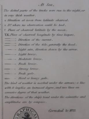
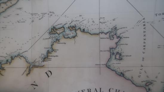
Some years ago a facsimile edition of Flinders chart was published and I was lucky enough to be given a copy. Attached is a photo of the symbols used. Flinders named many places around the Australian coast but many places had already been named and charted by the French and Dutch explorers.
In the book Capes and Captains " A comprehensive study of the Australian coast" by Professor Rainer Radok, details of places visited by many of these voyages of discovery are given and for the year 1802:
"OBSERVATION ISLAND. LIEUTENANT FLINDERS WENT TO COMMENCE A SERIES OF OBSERVATIONS FOR THE RATES OF THE TIME KEEPERS".
This was Samuel W. Flinders who was second lieutenant on the Investigator.
Observation Island is to be found on Google Earth in the Pellew Islands at 15 deg 36 min South 136 deg 54 min East.
John Brown
Adelaide
South Australia


