NavList:
A Community Devoted to the Preservation and Practice of Celestial Navigation and Other Methods of Traditional Wayfinding
Re:Moonrise-over-Connecticut
From: Peter Blaskett
Date: 2021 Nov 3, 21:59 -0700
From: Peter Blaskett
Date: 2021 Nov 3, 21:59 -0700
Bill,
The Navigation data given by ICE will be the positions of the body centre, and the refraction given will be for the altitude (Hc) of the body centre. But for Sun and Moon work we will want a refraction figure for the upper or lower limb we observe; and this refraction will have to be different than the ICE value given.
As an aside, I don't use ICE for any purpose.
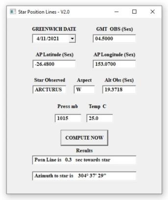
For navigation I use 'NAVIGATOR' by Omar Reis, and this is perfectly fine. For serious azimuths (I am an old surveyor and map-maker) I use my home-grown version of 'Star Almanac for Land Surveyors' for which I wrote a little windows interface (to do position lines and azimuth) years ago.
Here is a screen shot of it :-


