NavList:
A Community Devoted to the Preservation and Practice of Celestial Navigation and Other Methods of Traditional Wayfinding
From: Frank Reed
Date: 2019 Oct 27, 11:32 -0700
I wrote earlier:
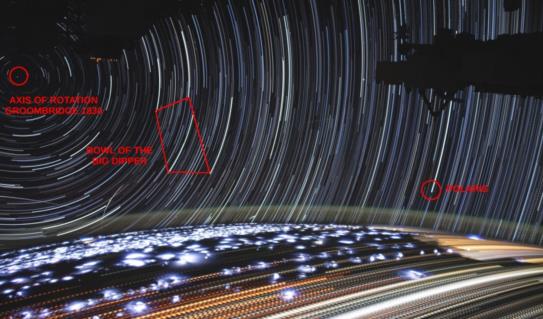
"I can't figure out the stars here. What constellations are we looking at?"
I kept looking at the image, and I think I have it figured out. That's the bowl of the Big Dipper a bit left of center, which means that Polaris is the bright trail below and behind the structure on the right. The "pole" of rotation off the station's port beam is around Declination 38° N and RA 11h 56m (equiv to about 181° SHA). The star which is nearest to a pole star in this image is possibly/probably Groombridge 1830. These clues together imply that the station's latitude ranged from about 10° S to a few degrees N of the equator during the time-lapse, and we are looking NW so the station is on an ascending pass heading northeast. Given that we're looking at land during this passage, the station is either over the South Atlantic, and we're looking at Brazil, or the station is over the western Indian Ocean, and we're looking at Africa.
Frank Reed


