NavList:
A Community Devoted to the Preservation and Practice of Celestial Navigation and Other Methods of Traditional Wayfinding
Re: Navigate by Skyline
From: Don Seltzer
Date: 2022 Aug 27, 18:37 -0400


From: Don Seltzer
Date: 2022 Aug 27, 18:37 -0400
I haven’t been to NYC for nearly a decade, and these new fangled buildings are alien to me. I stuck with what I knew, the Empire State Building and the Chrysler Building, on the right side of the photo.
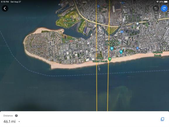
The odd red tower puzzled me, and I first thought it might be found at JFK. But then I remembered what an ancient mariner of the 1950’s had told me: when approaching the harbor, one of the first recognizable objects to pop up over the horizon was the Parachute Jump at Coney Island.
Having identified it, I then noticed the Ferris wheel further along the beach, which was nearly lined up with the Chrysler Building. I then drew the corresponding lines on Google Earth. One from the ESB through the Parachute Jump, the other from the Chrysler Building to just west of the Ferris wheel.
They intersected on Sandy Hook. I then looked for the nearest likely spot where a photographer might set up his tripod and have a clear view towards Manhattan. I picked the large parking lot about a half mile to the north as a sensible location.
Don Seltzer
On Sat, Aug 27, 2022 at 3:30 PM Frank Reed <NoReply_FrankReed@navlist.net> wrote:
Don,
My estimated position from the skyline photo is about two-thirds of a nautical miles north of yours. Given a generous error ellipse, those locations may both be reasonable. :)
Frank Reed


