NavList:
A Community Devoted to the Preservation and Practice of Celestial Navigation and Other Methods of Traditional Wayfinding
Navigating with GPS, optically
From: Peter Monta
Date: 2018 Jan 19, 00:42 -0800
From: Peter Monta
Date: 2018 Jan 19, 00:42 -0800
I thought I'd try some celestial navigation using optical imaging of satellites. It has been talked about before on NavList, but the Internet remote telescopes make the whole process quite convenient.
The most suitable targets seem to be those with publically-available, high-precision, and relatively stable orbits. All the GNSS satellites are in this category, as are some bright SLR (satellite laser ranging) targets like LAGEOS and Etalon. The orbits are actually far better than can be used by optical techniques: the individual images give sky positions good to ~0.2 arcsecond, but the real-time orbits are good to a decimeter at MEO distances (~1 mas).
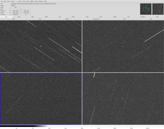
As a first cut I decided on a group of four GPS images (screenshot attached). These were taken with the iTelescope.net telescope T32 (0.4 meter aperture, 10 second exposure).
Here are the apparent positions derived from the images:
NORAD number Exposure midpoint (UTC) RA (ICRS) Dec (ICRS)
------------ ----------------------- --------- ----------
27663 2018-01-11T15:32:09.472 11h 28m 07.96s -05d 46' 25.5"
40534 2018-01-11T15:33:38.558 12h 50m 08.69s -32d 27' 14.2"
28361 2018-01-11T15:37:10.322 06h 35m 32.29s -58d 41' 58.5"
40294 2018-01-11T15:38:38.665 08h 45m 07.84s -24d 19' 06.6"
From where were the photos taken? There's enough information for latitude, longitude, (geodetic) height, and time, that is, a full 4D position. What spatial uncertainty can be justified? How about for the time ("chronometer error", or "receiver clock bias" in the modern lingo)?
The millisecond timestamps for start-of-exposure maybe can't be entirely trusted (includes shutter lag or not?), but the difference between them should be pretty good. Also, the cross-trail (as distinct from cross-track) position of the satellite is better than the along-trail, since the latter is limited by the quality of the star-streak estimator in the long direction (and by the SNR of the streak). So covariance for the positions and times should be taken into account.
There were optical satellite-geodesy projects in the mid-1960s (a fascinating story). But now, instead of needing to field large cameras and a team of specialists, you just need a computer and $20 of telescope time.
Cheers,
Peter
ps: the satellite in the bottom-right image is a little trailed, but not enough to seriously impact the astrometry. Still trying to figure out what went wrong there with the tracking rates. Maybe it's the telescope's fault (sure).


