NavList:
A Community Devoted to the Preservation and Practice of Celestial Navigation and Other Methods of Traditional Wayfinding
Re: Navigation errors and Sahara crash 1952
From: Greg Rudzinski
Date: 2015 May 31, 16:18 -0700
From: Greg Rudzinski
Date: 2015 May 31, 16:18 -0700
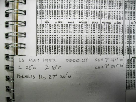
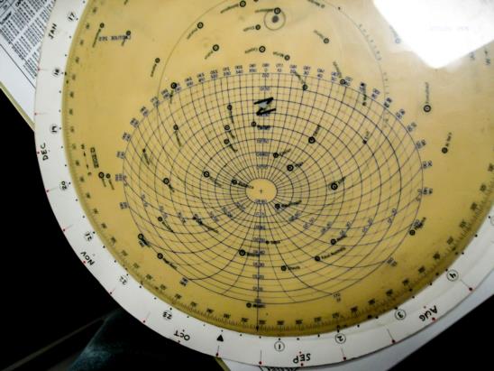
Here is what the Captian and Co-Pilot were looking at early in the flight (UT 0000 5/26/1952 Lat. 28° N Lon. 10° E) when there was still a chance to save the night. See Pub 249 vol. 1 LHA Aries 253° Lat. 28° N and 2012-D using a 25° North template set to LHA Aries 253° 30'. Antares was right in front of them. Alterng course 90° for a quick look at the big dipper and Polaris on the beam would have been so easy to do for a rough magnetic compass check. Saturn and Mars were together to the south west as extra bodies for observation. Was it a practice in 1952 to carry a hand held bubble octant in the cockpit as back-up to the periscope ?
Greg Rudzinski


