NavList:
A Community Devoted to the Preservation and Practice of Celestial Navigation and Other Methods of Traditional Wayfinding
Re: New compact backup CELNAV system RENAMED Accuracy of Bygrave Slide Rule
From: UNK
Date: 2009 Apr 14, 16:25 -0700
From: UNK
Date: 2009 Apr 14, 16:25 -0700
So your MHR-1 doesn't provide for cases where the declination is less than
20', the lowest mark on the cotangent scale. Bygrave says to use the same
procedure in this case as in the case where the azimuth is near 90?, simply
interchange the declination and the latitude and then compute the altitude
and this works fine and you get accurate altitudes. But the azimuth that you
derive in this process is not the correct azimuth and is thrown away and not
used for plotting the LOP just as in the case of azimuths near 90?. Bygrave
gives no instruction for computing the azimuth in this case. It cannot be
computed in the normal way since the first thing you need to to is find
declination on the cotangent scale and values less than 20' are not on the
Bygrave or MHR-1. This is an important special case since the sun's
declination is in this range for several days around each equinox. I
developed an approximation that works well giving azimuths within one degree
of he correct value and usually much closer. I simply skip the first step, he
derivation of "y" (Bygrave's terminology), "W" (my terminology). I simply set
"y" equal to declination and then proceed normally.

The reason that you need to do the second computations when azimuth is within
5? of east or west is that the Hc becomes very sensitive to the azimuth and
rounding up or down one half minute (as you must do since the scale is marked
only every minute) in the azimuth will make a big difference in the Hc. I am
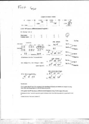
attaching four files. The first one is the Bygrave computation carried out on
a calculator which produces the correct azimuth, 87? 30' 21" and the correct
Hc of 41? 18' 25" .

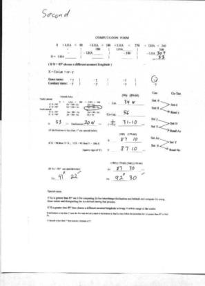
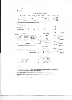
Files second and third shows what happens when you take out the azimuth as 87?
30' and as 87? 31'. These produce Hcs of 41? 22' and 41? 11', both values far
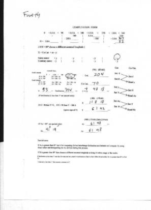
away from the correct value. The fourth form shows the computation done a
second time as the Bygrave and MHR-1 rules state by interchanging declination
and latitude and produces an Hc of 41? 19' withing .6' of the correct value
and.

gl
--~--~---------~--~----~------------~-------~--~----~
Navigation List archive: www.navlist.net
To post, email NavList@navlist.net
To , email NavList-@navlist.net
-~----------~----~----~----~------~----~------~--~---


