NavList:
A Community Devoted to the Preservation and Practice of Celestial Navigation and Other Methods of Traditional Wayfinding
Re Obtain a fix when you don't have an clear AP.
From: John Brown
Date: 2015 Jan 20, 14:36 +1030
v\:* {
BEHAVIOR: url (#default#vml)
}
From: John Brown
Date: 2015 Jan 20, 14:36 +1030
|
Sean
Like a lot of equations in navigation it is either + or - depending on whether the Latitude and Declination are the same or different. In this case they are different and so the appropriate sign is +.
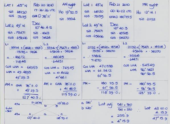
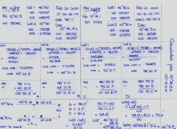
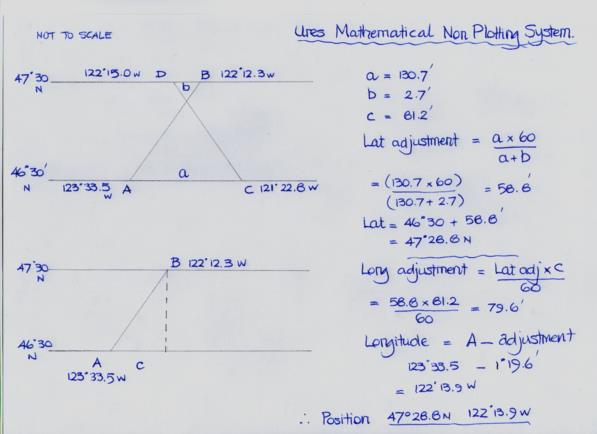
I found the Sumner method a great way to learn nav. A few years ago I purchased some inexpensive cancelled charts covering different parts of the world. They can be purchased online at a reasonable price from Marine Chart Services in the UK . An added bonus of purchasing cancelled charts ( not to be used for navigation ) is that they quite often come complete with the tracks and positions of their last voyage and you get to see how the experts do it. I would select a place eg the anchorage in Bombay Harbour, calculate the sun's meridian passage and then the sun's altitude about two hours either side of this time. I would treat this as my sextant altitude (no corrections required ) and using the Sumner / Ure method, logs and five figure trig tables hopefully find my way back to where I started. Using old charts in this way also gets you acquainted with working in different hemispheres. I am a South Latitude East Longitude person and working on positions in America still seems back to front.
My own interest is taking sun sights using shadows and for these calculations I use a Tandy PC6 pocket computer and the St Hilaire method but when I manage a good morning and afternoon set I like to give them the full Sumner / Ure treatment.
John K
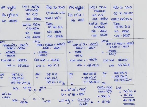
I think I know where the problem lies. When Sumner made his remarkable discovery he calculated for latitudes 51 and 52 north. All the textbooks that cover his method use latitudes about a degree apart hence not much chance for error and no iteration required. However the current exercise requires some thinking outside the square because the two latitudes are 20 degrees apart and without iteration large errors would occur. The first iteration gave a latitude of 46 deg 06 min N. I didn't bother calculating for longitude, but if I had done so and offered this up as the answer to the problem then everyone would have had a good laugh.
As to the terminology, I don't think that there is an appropriate one to cover the whole of a country as is needed in this case. Those of us who are learning our nav from books come up against different names for the same things and we tend to stick to those we like best or seem the most appropriate. I certainly have no problem with that if I get right results but it is a bit embarrassing to use the wrong term in a public forum.
John D H
There is currently a copy of Charles Ure's book for sale on abebooks. I have another of his books published in 1965 but it is so difficult to understand that I haven't been able to get past the first few pages without becoming completely confused and unsure of what I already know ( or think I know).
He doesn't mention Sumner in his book but as he was a surveyor with the Australian army, a teacher of navigation and sailed his yacht from Australia to New Zealand and return, I would suspect that his main idea came from Sumner and perhaps the brilliant calculation at the end from his experience as a surveyor.
You mention an aversion to logs. All my life I have avoided any formula that deals with haversines but the recent introduction of the Doniol system by Greg R has forced me to confront my demons and now I can't imagine what all the fuss was about.
Regards,
(the other)
John Brown. | |||
|
|


