NavList:
A Community Devoted to the Preservation and Practice of Celestial Navigation and Other Methods of Traditional Wayfinding
From: Lyle Ruppert
Date: 2022 Feb 17, 16:26 -0800
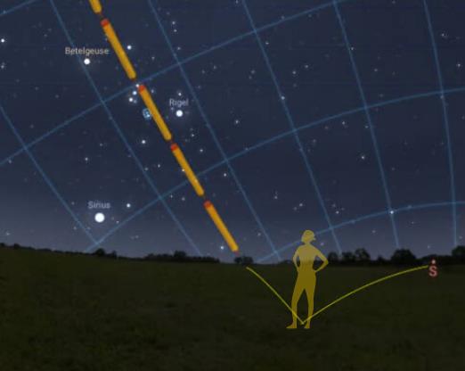
Some have been interpreting the Orion north vector as simply identifying an hour angle on the celestial sphere. They use it to intercept the local horizon (fig 1) and are disappointed to find that the bearing to this intercept varies with time of day and latitude. Indeed, there are many sets of stars that share a common hour angle and could be used in this way if it were found to be useful for some purpose. But it is not so useful for direction-finding.
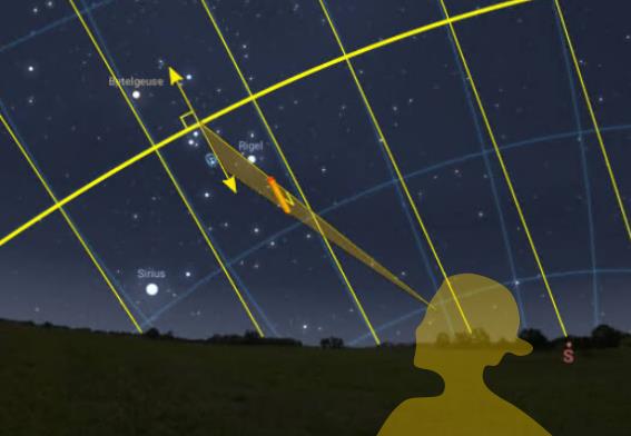
What is special about the Orion arrow is its location on the celestial equator. It gives both the position of the equator and a vector at right angles to the equator in a single view. If you orient a local pencil (not a celestial pencil) parallel to that vector (taking care to keep the pencil perpendicular to your line sight toward the belt) then you are holding a local (topocentric) copy of the celestial axis and so of the Earth's axis (fig 2). (Side note: It isn't necessary to picture anything in particular in the sky, but if it helps you can picture not the celestial sphere but a celestial cylinder, tangent to the sphere at its equator and having an axis parallel to Earth's rotation axis.)
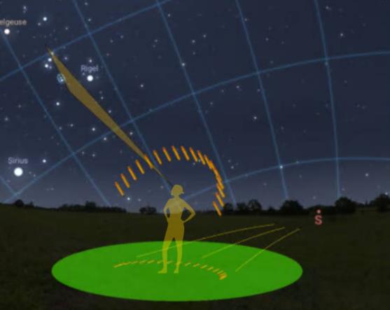
Taking a pencil so oriented and projecting it onto the local horizontal plane gives a reliable north-south line at any time of night (fig 3).
Your latitude doesn't matter. Orion can pass high in the sky or low in the sky (fig 4). The projection to the ground (equivalently, the local vertical plane containing the pencil) will be a reliable north-south indicator.
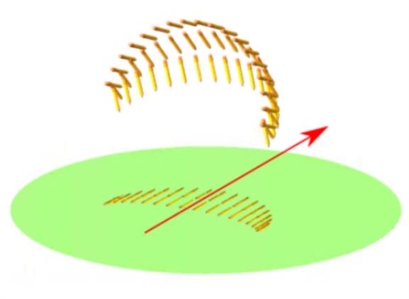
The pencil is your private copy of the Earth's (laterally displaced) rotation axis, no matter where in the world you are set up (fig 5). This would be the same axis used to align an equatorial-mount telescope or the fast (daily) axis of an efficient solar tracker (though many 2-axis trackers get this wrong).
To teach the method, a laser pointer might be useful. It could be taped squarely to the end of a meter stick to form an "L". First at the far end of the stick, it could be aligned to Orion and project a spot on the ground north or south of the sub-laser point. You could also reverse the stick and align the unadorned end to Orion in order to direct a beam from (not into) your eye to a point directly north or south of you. Once the concept is clear you don't need such props.
Illustration credits:
sky scene -- Stellarium.com
observer silhouette -- Dimensions.com
full globe -- Google Earth
--Lyle


