NavList:
A Community Devoted to the Preservation and Practice of Celestial Navigation and Other Methods of Traditional Wayfinding
From: Robin Stuart
Date: 2024 May 29, 09:56 -0700
Robert,
That you very much for the earlier Aspley reference. I will amend the text and references accordingly.
On the thread of the Dutch connection: van Poelje (https://eeuwen.home.xs4all.nl/images/Pics/Kombuispraat/Pleinschaal/200404 Gunter Rules in Navigation V13-1.pdf) states
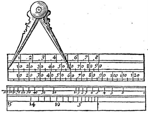
Aspley only gives a picture of the front side, but in reference [16] the Dutch expert on the history of navigation, Ernst Crone, supplies a picture of front and back of the Plain-Scale. This more complete picture has been found in a Dutch handbook for navigators [8] which addresses the same subject as Aspley’s book, though without any reference to him.
In Figure 10 entitled "Aspley's Plain Scale" he shows a drawing of both the front and back sides. I have attached it here. However the scales from the back side don't appear to be consistent with the description that Aspley gives and that I quote in full in the paper. In particular one of the scales appears to be logarithmic.
Regards,
Robin Stuart


