NavList:
A Community Devoted to the Preservation and Practice of Celestial Navigation and Other Methods of Traditional Wayfinding
From: Gary LaPook
Date: 2015 Nov 30, 21:39 -0800
Frank asked about using the pole as an AP and whether it was P.V.H. Weems who had invented that method.
"To see the simple connection between hour angle and azimuth near the pole, go to the USNO Celestial Navigation data page here and for your assumed position enter 88° 00' N and 180° 00' W (the longitude doesn't matter much but it makes it easier to see what's going on). When you calculate the data, you will discover that the GHA values and the Zn values are nearly identical. This even leads to a simple technique of navigation when near the pole: use the pole itself as the AP and then the declination of any body is identical to the Hc while the GHA serves as a surrogate for Zn. While azimuth (Zn) is formally undefined at the pole, this is really a mathematical curiosity rather than a real problem. In mathematical terms we would imagine a "final approach" to the pole "in the limit" as latitude approaches 90° along the meridian of 180° longitude since then GHA and Zn are identical on that path, in the limit. At the pole, replace Zn by GHA, and we're done. See how simple that is? Sight reduction near the pole is as easy as this: Hc=Dec, Zn=GHA for any body at any time. So as long as we can deal with the usual issues of long intercepts, anywhere within a few hundred miles of the pole, we can immediately compare measured (corrected) altitudes with the body's declimation and then get the distance of our LOP from the pole. The "azimuth" of the intercept from the pole is simply the GHA. Plot and you're done. By the way, does anyone recall: was this methodology a Weems invention?
Frank Reed"
https://NavList.net/m2.aspx/Azimuth-Angle-Time-Diagrams-FrankReed-nov-2015-g33717
=======================================================
I replied with a link to my prior posts:
https://NavList.net/m2.aspx/Polar-navigation-LaPook-oct-2009-g10186
"Re: Polar navigation
From: Gary LaPook
Date: 2009 Oct 19, 01:30 +0200
There were also the "Ellsworth Tables" that provided corrections to the
straight line LOPs so that the pole could be used for a greater
distance. These tables are similar to the correction tables found in
H.O. 229. They were developed by Lincoln Ellsworth who first tried
navigating over the North Pole in 1925. See
https://www.south-pole.com/p0000110.htm
about this harrowing adventure.

gl


bmorris{at}tactronics.com wrote:
> Hi Peter
>
> >From Dutton's Navigation and Piloting, 1972.  Article 4213
>
> "One special method of plotting lines of position is available only in polar
regions. Byt this method the pole is used as the AP ...  This method was
first suggested at least as early as 1892, but there is no evidence of its
having been used until some 30 years later. In the early days of air
exploration in polar regions the method was quite popular, but with the
develpoment of modern tabular methods, it has fallen into disuse, except
within 2 degrees of the pole."
>
> Dutton goes on to state that the method will be accurate for meridian
alititudes at any latitude, as a special case.
>
> Dutton gives about 20 pages to special techniques used in the polar regions.
>
> Hope this helps!
>
> Best Regards
> Brad"
==========================================================================
And to other prior posts:
https://NavList.net/m2.aspx/simple-threebody-fix-puzzle-LaPook-dec-2010-g14679
===================================================================
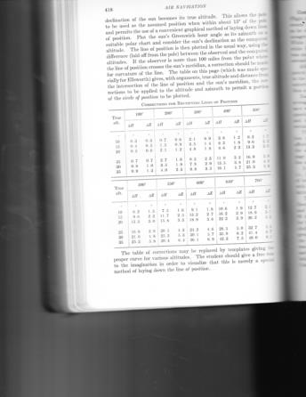
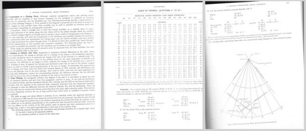
It does appear tha Weems did have something to do with implementation of this method. In his "Air Navigation" (1938 ed.) he devotes two whole chapters to the navigation by Ellsworth of a flight across Antarctica in 1935 and prints on page 418 what came to be called the "Ellsworth tables" that are used to correct the LOP for curvature when using the pole as the AP. Weems states "The table on this page (which was made specially for Ellsworth) gives,..." makes me think that it was Weems who specially made the table for Ellsworth. See attached.
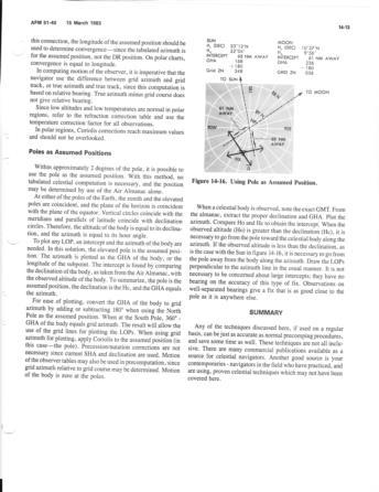
The "Ellsworth Tables" were then incorported in AFM 51-40 (1951 ed.), see attached.
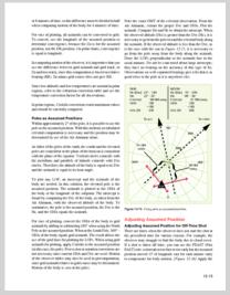
A shorter explanation of using the pole as an AP was in the 1973 and 1983 editions of AFM 51-40 and also in the the current Air Force Navigation Manual, AFPAM 11-216 (2001) and also in the FAA Flilght Navigation Manual, 2011, see attached.
A modified Ellsworth table is also found in each volume of HO 229 for making corrections for the curvature of the LOP and, in volume 6, covering latitudes 75 through 90 degrees, there is also an explanation of using the pole as the AP, see attached.
gl
