NavList:
A Community Devoted to the Preservation and Practice of Celestial Navigation and Other Methods of Traditional Wayfinding
Polaris Latitude Wheeler
From: Bela Kovacs
Date: 2024 Mar 8, 03:57 -0800
From: Bela Kovacs
Date: 2024 Mar 8, 03:57 -0800
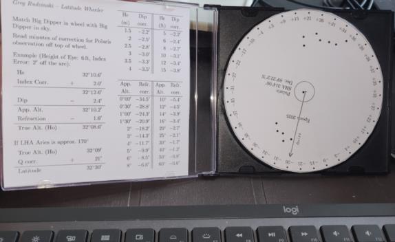
Greg Rudzinski created a useful tool/diagram, the Polaris Latitude Wheeler. I made a CD/DVD-disc size version based on his work.
I used these coordinates of the Polaris to generate it:
SHA 314°06′
Dec. 89°22.2′ N
This can be modified in the source code to generate the diagram for any Epoch.
The LaTeX source code is available on my website:
https://toody.hu/celnav/GR-polaris-latitude-wheeler.zip
In the data.tex file, the StarCoords array contains the data of stars. The code plots the first "NumberOfStarsToPlot" stars from the array (you can add more stars, e.g. Little Dipper). The coordinates of Polaris must be in the first line. (It must also be included in PolarisLabel formatted accordingly.)
Bela


