NavList:
A Community Devoted to the Preservation and Practice of Celestial Navigation and Other Methods of Traditional Wayfinding
From: Frank Reed
Date: 2023 May 25, 09:40 -0700
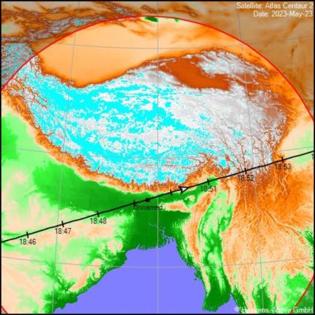
Somewhat coincidentally, in this specific case, the "satellite LOP" is nearly identical to the satellite ground track. The ground track is easy to acquire since it's part of the standard ephemeris solution for a satellite. The website heavens-above.com provides ground tracks for all satellite pass predictions. I'm including that below for this Assam pass of the Atlas-Centaur. It's almost the same as the the satellite LOP in this specific case because the satellite nearly passed through the zenith at the photographer's observing location. Note that this is not normally the case. For example, on this satellite pass, if the satellite's maximum altitude had been 85°, then the satellite LOP would have been displaced north or south of the ground track (and not in a simple way) by approximately 60km.
Frank Reed


