NavList:
A Community Devoted to the Preservation and Practice of Celestial Navigation and Other Methods of Traditional Wayfinding
From: Frank Reed
Date: 2020 Jan 29, 11:29 -0800
This is off-topic, but too extraordinary to miss. It's also a local northeast US event, but we do have a lot of NavList members/readers in this part of the world.
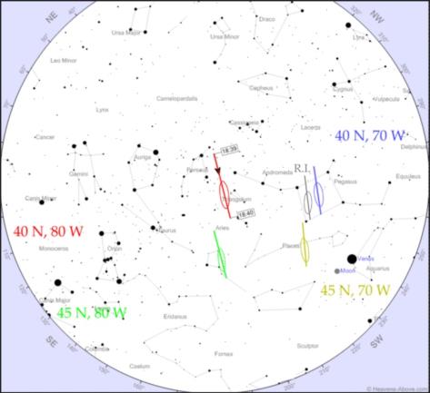
Tonight just after 6:39 pm Eastern Time two defunct satellites may collide about 900km high over western Pennsylvania. Odds are currently estimated at 5% which is definitely worth a look. If it happens, this will be visible over the entire northeast US as well as southern Ontario and Quebec as a small flash or flare. This will be a head-on collision, which means high energy, high destruction, and also some debris bits would be projected downward possibly entering the atmosphere as visual "meteors" as soon as three to five minutes after the collision. Follow news updates here: Google News: IRAS Satellite.
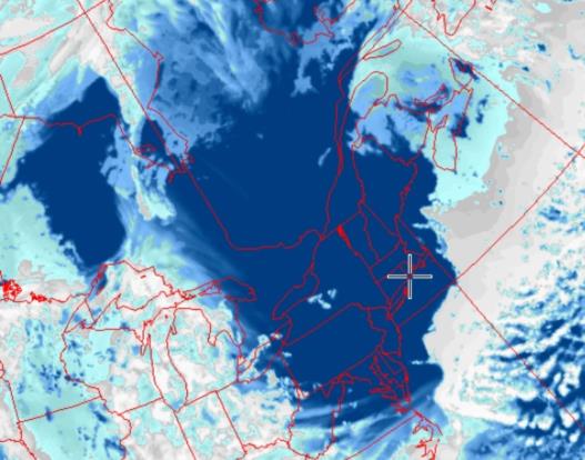
Attached are images showing approximately where the collision would be seen in the sky (if... if... if... it happens!) from various location in the northeast. Check heavens-above for your location. You can edit the URL here. Just change the lat lon to yours. Skies are expected to be clear, too. There's a crescent Moon which may make it difficult to follow the satellites before collision. IRAS is the brighter of the two and might be followed in binoculars.
I know I shouldn't... but I want some fireworks!
Frank Reed


