NavList:
A Community Devoted to the Preservation and Practice of Celestial Navigation and Other Methods of Traditional Wayfinding



From: Robin Stuart
Date: 2026 Aug 24, 06:25 -0700
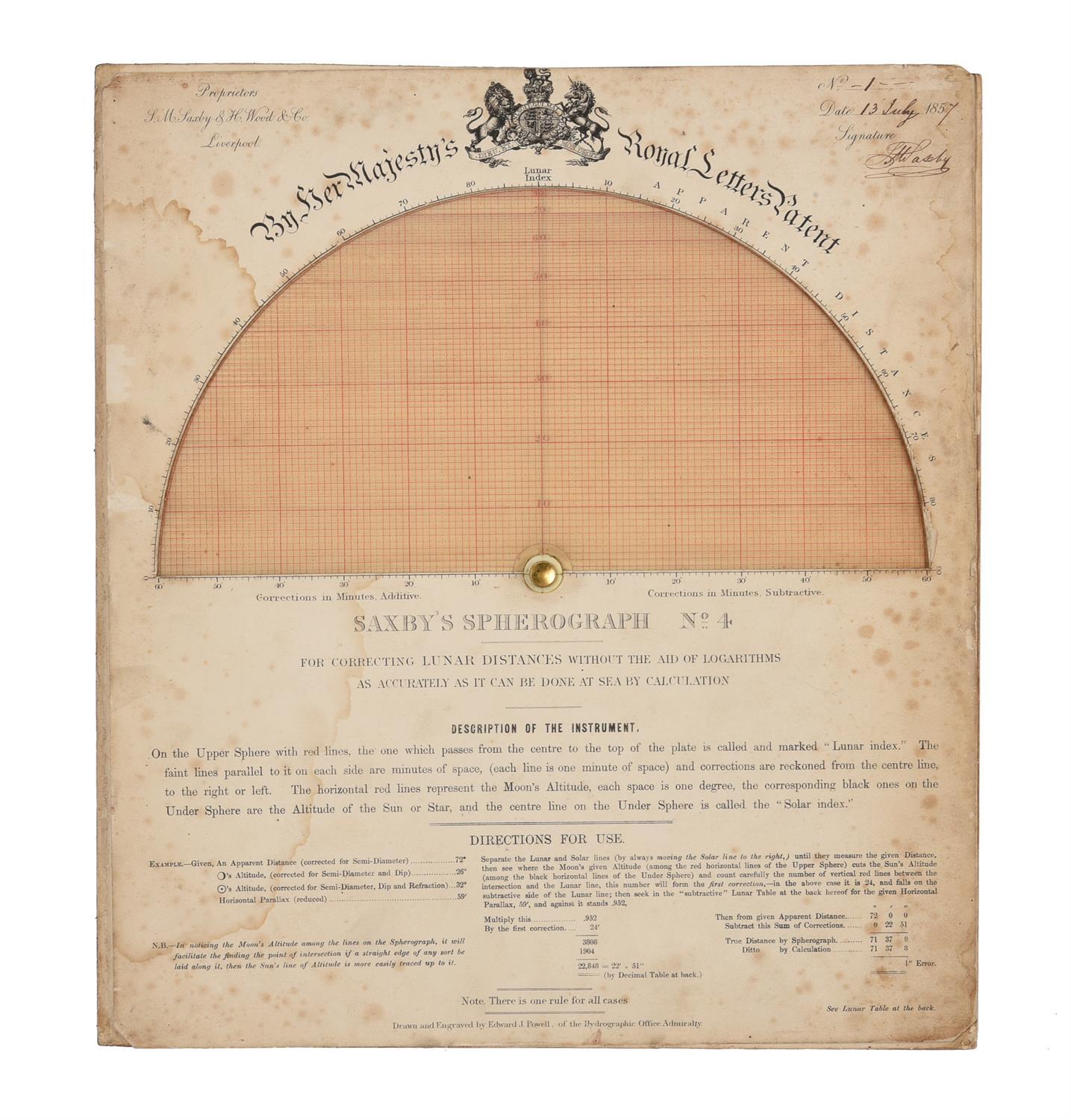
In looking into the Weir diagram (https://www.cambridge.org/core/journals/journal-of-navigation/article/conception-and-development-of-weirs-diagram/67A525A41723E28F76AE701B78705C55) I came across a mention of Saxby's Spherograph. In 1889 Captain Patrick Weir, in comparing his diagram to alternatives, stated that "The spherograph is rather a costly affair (about £2 I believe), and for that reason has not come into general use".
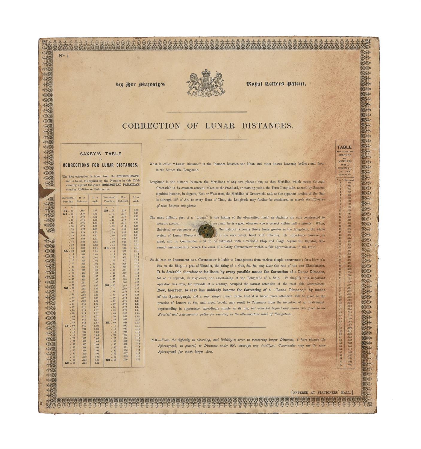
The Spherograph consists of several devices based on equatorial stereographic projection, similar to Chauvenet's Great Circle Protractor and nowadays known as a Wulff Net. These make use of some of the properties of stereographic projection I described in my paper on the Plane Scale (https://navlist.net/Plane-Scale-Stereographic-Projection-Early-Navigation-Stuart-may-2024-g55907). The devices consist of a fixed black grid called the "Under Sphere" and a red "Upper Sphere" that rotates about the centre and is printed on transparent material. On page 200 of The Nautical Magazine and Naval Chronicle for 1857 (https://dn720005.ca.archive.org/0/items/the-nautical-magazine-1857/The_Nautical_Magazine%201857.pdf) Saxby writes "I have moreover succeeded in producing another form of Spherograph, not before named to the public, in which one may most easily clear a lunar distance from parallax and refraction - and this even to seconds." I found images of this Spherograph No.4 which I have attached. I have made some progress in reverse engineering its basic principles. I have written up my findings so far in the attached document however don't understand how "SAXBY'S TABLE OF CORRECTIONS FOR LUNAR DISTANCES". I hope that there is someone on Navlist who can shed some light on the matter.
Robin Stuart