NavList:
A Community Devoted to the Preservation and Practice of Celestial Navigation and Other Methods of Traditional Wayfinding
Sea level defines Empire
From: Frank Reed
Date: 2015 Apr 8, 22:58 -0700
From: Frank Reed
Date: 2015 Apr 8, 22:58 -0700
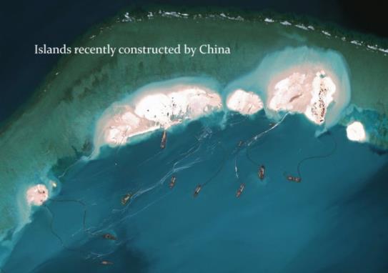
Last month, in the context of the Vesta Wind racing yacht grounding on a vast atoll in the Indian Ocean, so well-known that it can be found on the smallest of globes even 75 years ago, I mentioned my feeling as a cartographer that very shallow water, non-navigable shallows, deserve the same attention as dry land in some mapping contexts. But why wait? The 'powers that be' can build land in those shallows if map-makers refuse to comply. The Chinese have learned this lesson... Make islands, create sovereignty... Read on...
Frank Reed
ReedNavigation.com / HistoricalAtlas.com
Conanicut Island USA


