NavList:
A Community Devoted to the Preservation and Practice of Celestial Navigation and Other Methods of Traditional Wayfinding
From: David C
Date: 2017 May 20, 02:35 -0700
Theses days books can be purchased on line. However I rarely buy books this way and much prefer to take my chance with a bricks and mortar second hand book shop.
A few days ago we were driving though a small rural town and SWMBO [1] wanted to use a public toilet. We found one down a side street. Across the road was a large building containing a second hand shop. I decided to fill in time by crossing the road and poking my head in the door. I was expecting the shop to be filled with junk. Imagine my surprise when I discoverd that one third of the shop was filled with books. It is amazing how the spines of navigation books stand out amongst the rubbish. I quiickly laid my hands on a copy of Hughes - the 1950 reprint of the 1938 edition. I paid $10 NZ - a later check online found a copy going for about $50 US.
The next day we were driving through another small town closer to home. It is a typical decaying small town except that a few weeks ago a book shop had opened in an empty shop. I had not bothered to visit. After my success the previous day I decided to go in and was surpised at the extensive collection of books. Unlike many oher bookshops there was a reasonable selection of technical books. I hate shops that just sell glossy coffee table books. In fact I ignore large format books with glossy dust jackets. Here is what I purchased:
The Complete Air navigator DCT Bennet 1957 reprint.
Studies For Student Pilot M Boyce 1955. It has a section on DR navigation, map reading and the Dalton computer (spelt computor).
A Text Book of Theodolite Surveying and Levelling J Park 1915. It contains a 100 page section called "The Determination of True Meridian, Latitude and Time". Judging by the annotations the book was well used by the owner Mr Keith Kitto.
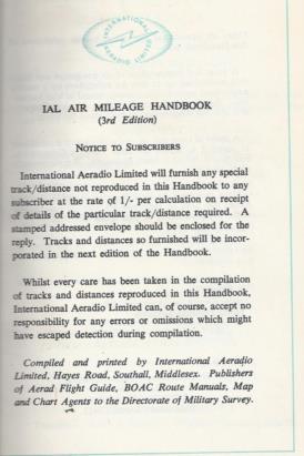
IAL Air Milage Handbook (1950s). There are explanations of how to calculate rhumb line and Great Circle distancesas well as an extensive set of tables. For example Auckland (Whenuapai) to London Airport is 9894nm, 11394 st m, 18336km by great circle. The track column is blank but if I want to go to Wellington (Rongotai) the track is 178 deg T and distance 272 nm by rhumb line. International Aeradio Ltd will calculate any track not in the list on payment of 1/-. (A rip off?)
A few weeks ago ago at the local annual book fair (71,000 volumes) I picked up reprint of Shackleton's South. I also purchased a 1600 page two-volume set called Shipping Wonders of the World, published sometime between 1935 and the start of the war. It is one of those very annoying books that does not have a publication date. It has an extensive section on navigation. What is relevant to this forum is that it confirms that in this era the standard method in the merchant marine was long by chron and meridian altitude. There is no mention of intercepts, Sumner, Marc St Hilaire or position lines. In the 2016 Fair I had picked up a copy of Bowditch 1958. The bonus is that all books were $2 each.
[1] UK readers will (should) know that SWMBO = She Who Must Be Obeyed, a term used in a BBC television programme of quite a few years ago.


