NavList:
A Community Devoted to the Preservation and Practice of Celestial Navigation and Other Methods of Traditional Wayfinding
From: Murray Buckman
Date: 2023 Sep 19, 13:08 -0700
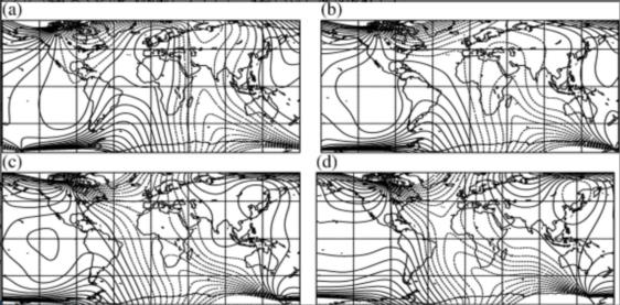
Further to the question of Captain Onedin's chart and the curved lines, and my guess that they are isogonal lines.
The attached image (poor quality) shows the magnetic variation (or declination for you land-based folk) over four centuries. (c) is the 19th century (assume mid-century). The isogonal lines are at each 5 degrees. The general shape in the North Atlantic is broadly consistent with the chart depicted in The Onedin Line.
Perhaps this speaks to the effort put into the historical accuracy on the show.
The source of this diagram is "Four centuries of geomagnetic data from historical records" by Art R. T. Jonkers, Andrew Jackson, Anne Murray. It is available online here:
https://agupubs.onlinelibrary.wiley.com/doi/full/10.1029/2002RG000115


