NavList:
A Community Devoted to the Preservation and Practice of Celestial Navigation and Other Methods of Traditional Wayfinding
From: Andrés Ruiz
Date: 2015 Nov 9, 10:37 +0100
HO 203 & 204
Whoops! Also the TRUE ALTITUDE is considered as an independent variable, in addition to the LATITUDE and DECLINATION.
Sorry about that!
On Nov 6, 2015 1:48 PM, "Brad Morris" <bradley.r.morris---.com> wrote:Hello Andrés
Please add to your map this tabular method
HO 203: The Sumner Line of Position
and the volume of extended declinations
HO 204: The Sumner Line of Position of Celestial Bodies.I have attached the title page of each, the introduction to the 1923 HO 203, as well as a representative page of the table.
The table is entered with the LATITUDE and DECLINATION (same or opposite name) as independent variables and the HOUR ANGLE and AZIMUTH are obtained as the dependent variables.
The text explicitly states that there is a result in circles of position and it is by the intersection of the circumferences of two or more of these circles that the actual geographical position of the observer is fixed.
The 1923 volume is stamped with the vendor's name "Kelvin & Wilfrid O. White Co." Nautical Instruments, 112 State St Boston; 38 Water Street, New York. I wonder if this is related to our correspondent Ridge White, as it appears to be!!
This very early tabular method appears to have escaped notice
Brad
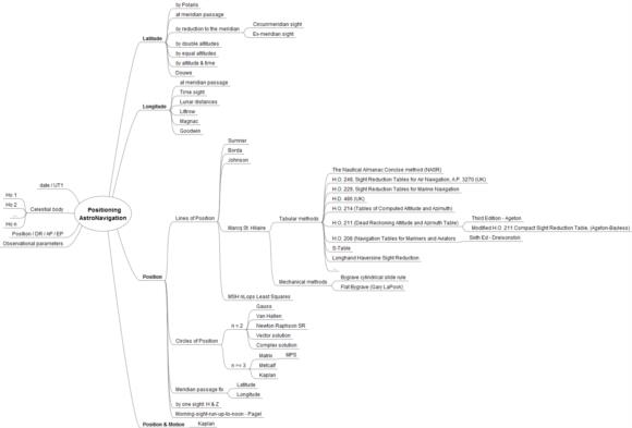
Hi,as a summary see the attached map.And more and more and...Attached File:
(img/133399.celestial-navigation---sr.png: Open and save)


