NavList:
A Community Devoted to the Preservation and Practice of Celestial Navigation and Other Methods of Traditional Wayfinding


From: Frank Reed
Date: 2026 Nov 17, 07:19 -0800
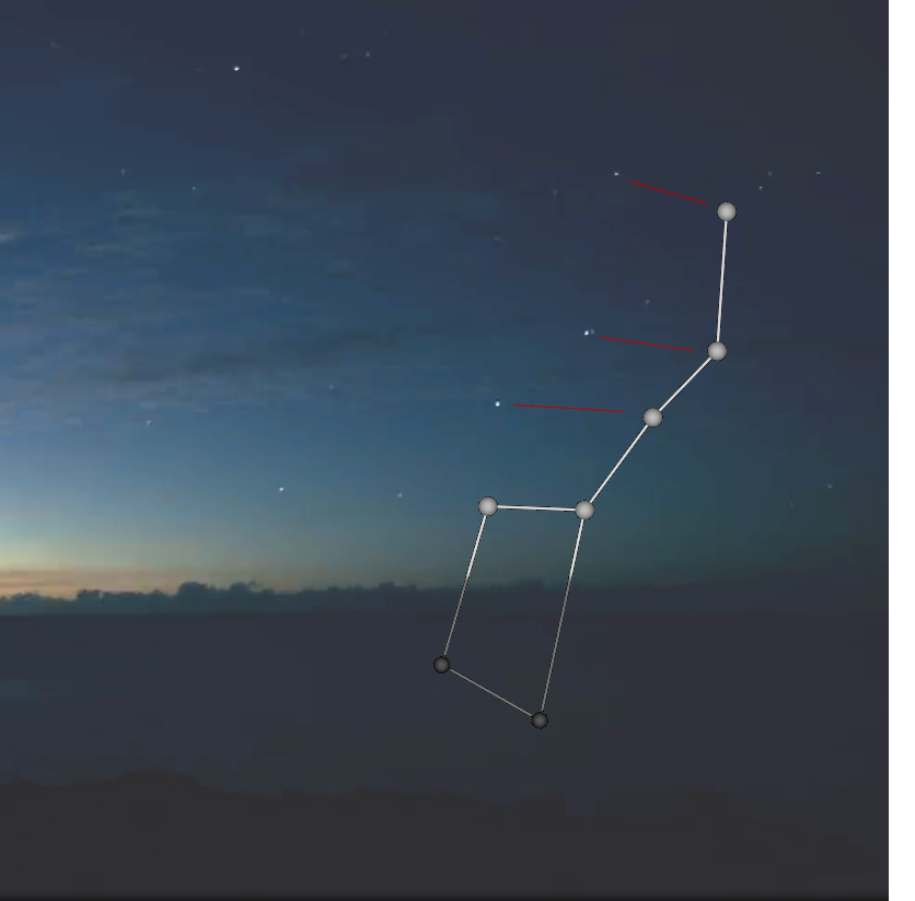
Rafael Caruso and David Pike both figured out that the recognizable stars in that photo were the Big Dipper, also known as the Plough. I've added a stick figure version of the star pattern below to illustrate the orientation. So what is our latitude? The Dipper/Plough alone doesn't give us an exact answer, but if you extrapolate to the Pointer Stars (below the horizon in the photo), they would clearly be aimed substantially below the horizon. That alone demonstrates southern latitude.
There's no point fussing over this one further. I will tell you the latitude: about 19.7° S. You could get close with the astronomy in the photo, but no need to waste time on it.
Previously I mentioned this spot was near a volcano. That volcano is about 500km from the maritime dateline (180° longitude). So where are you? What Royal Navy story begins here? And can you see the connection to King Charles II yet (not at this island, but later in that R.N. story)?
Frank Reed