NavList:
A Community Devoted to the Preservation and Practice of Celestial Navigation and Other Methods of Traditional Wayfinding
From: Frank Reed
Date: 2022 Dec 10, 17:42 -0800
David McN, you wrote:
"I have struggled to find an easy and effective way of planning using the star charts in the nautical almanac. I'm in Latitude 38 S and I judged my SHA to be about 013 for my local time 9pm tonight (GMT 9 Dec, 10:00:00.) I see Fomalhaut has SHA 15 and Dec S29. I judge 15 to be close to 13 so I think it will be a litte further west than my meridian and quite high in the sky. I see Altair has SHA 062 and Dec N9. So I judge it will be well over to the west and lowish. In fact, while my estimations of altitude are broadly correct, both stars end up with virtually the same azimuth, 281 and 287. So by going around the star chart and planning to use stars separated by SHA differences of at least 45 in this particular example wouldn't give me useful data. "
Consider what you're doing here. You're estimating the "hour angle" of each star. And you're doing that correctly. If you know the SHA of the meridian, then the HA of each star is just the difference:
HA = SHAstar - SHAmeridian.
The hour angle has a simple meaning in terms of the subStar point (where the star in question is at the zenith). The HA is just the difference in longitude between your position and the subStar point. You're also adding in some knowledge of your latitude and the star's declination. But what you're trying to do next is turn those into some estimate of the star's altitude and azimuth. But that right there --going from hour angle, dec, and latitude to altitude and azimuth-- is, in fact, the fundamental mathematical problem in celestial navigation. That's what the sight reduction tables do in the intercept method. That's what most of the tools of celestial navigation were created to do. So, in short, there's no "easy" answer to this problem. You're not doing it wrong in principle (*). You're simply not doing "enough" to get the information that you're looking for.
So how do we do it then? How do we go from HA, dec, and lat to altitude and azimuth? For the moment, I'll ignore azimuth. We can do it by direct computation:
sin Alt = sin Dec · sin Lat + cos Dec · cos Lat · cos HA.
That's the standard, basic equation of spherical trigonometry, and it is also little more than the standard equation for great circle distance between two points on the globe. For complete accuracy, this is the way to go. Just do that math. We can easily try it on your Altair example:
sin Alt = sin(9°) · sin(-38°) + cos(9°) · cos(-38°) · cos(62+13°),
which yields Alt = 6.0°.
Ah, but for sight-planning we can take shortcuts. We don't need accuracy. As others have already written, you can use apps. There are many including the "USNO web app clone" on my website as yet another example (the link I've given here will reproduce your numbers). Or you can use Pub.249 (or equivalent) which solves every possible case for a set of selected bright stars. Or... you can use a star finder. My loathing of the widely-available "star finder" that navigators use out of historical ritual --the HO-2102-D, so-called (in the glorious poetic rhetoric of navigators everywhere)-- is "well known". I don't recommend it. It's difficult to use, lacks key features, and it's easy to screw up. It does, however, have one key virtue: it's relatively cheap and easy to purchase. So get a used one and experiment, but if you find it fiddly and annoying, know this: it's not your fault! The thing is poorly designed.
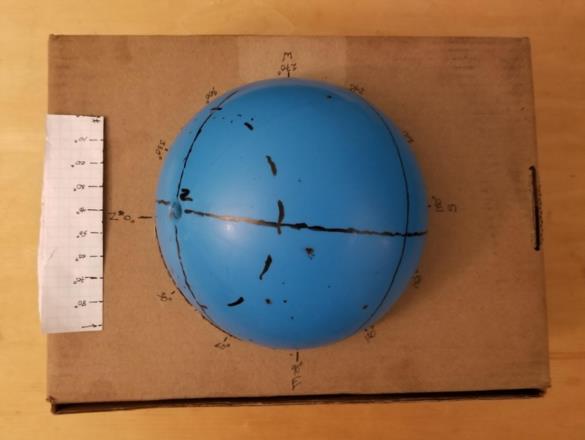
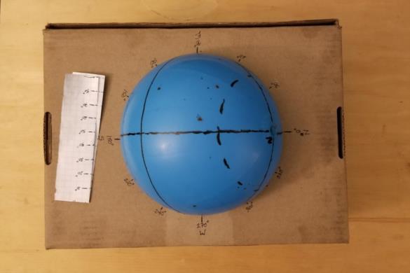
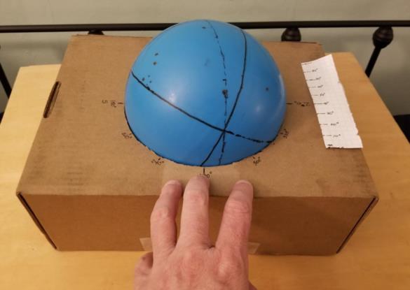
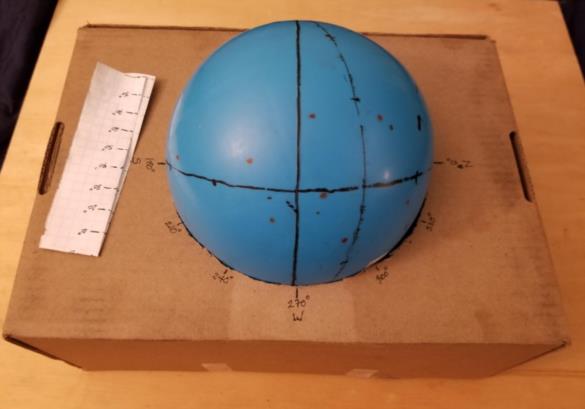
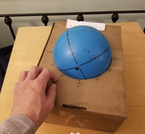
Since we don't require high accuracy for sight-planning, and since apps on smartphones and computers seem a little bit like "cheating" to many people, what we want is an analog computing tool of some sort. The star finder that I warned against above is the right idea, done very badly. It's a simple analog solution to the mathematical problem of getting altitude and azimuth from known HA, Dec, Lat. Cheaper than cheap and quicker shipping, too, is a homemade version. Although making your own two-dimensional star finder could be a pain in the neck, it turns out that a three-dimensional celestial globe sufficient for the task of sight planning is relatively easy to create and good clean fun. I've been wanting to do this for a while, so I took your question as an opportunity and made a simple star globe yesterday. You can do this yourself with a toy ball, some markers, and a cardboard box. It works for any date/time and any location on the Earth. I tried the setup for your case as described, and sure enough, I find Altair low in the sky, Fomalhaut high, and both on nearly the same azimuth. A few photos of my homemade star globe follow. It's easy to build and easy to use. Details on request.
You concluded:
"I end up having to work through the planning to find stars that will give usefully spaced azimuths rather than being quickly able to choose the best ones just by eyeballing the star charts.
This would still be a useful option, and there is a way. You need some transparent overlays, similar to the ones in the standard star finder. For the time being, for sight practice in your home area, you can make two or three overlays (one for each flat star chart in that section of the Nautical Almanac) specific to your latitude. Just line these up along the SHA of your meridian at the time you're interested in, and you're all set. I'll add a little more on this in another post.
Frank Reed
Clockwork Mapping / ReedNavigation.com
Conanicut Island USA
* Above I said you're not doing the hour angle calculation wrong "in principle". However there does appear to be a little error in the specific case here. You suggested "your" SHA, by which I assume you mean the SHA of your meridian, was 013°. Instead I find 347° or -013°. That may help you understand why your guess on Fomalhaut was so far off. Rather than being at nearly the same SHA as your meridian, off-meridian by merely 2°, it was 28° away. And being at fairly high altitude, you can see how it could run through a substantial range of azimuth.
