NavList:
A Community Devoted to the Preservation and Practice of Celestial Navigation and Other Methods of Traditional Wayfinding
Re: The Sun does not stop for anyone
From: Gary LaPook
Date: 2016 Dec 27, 02:58 -0800
From: Gary LaPook
Date: 2016 Dec 27, 02:58 -0800
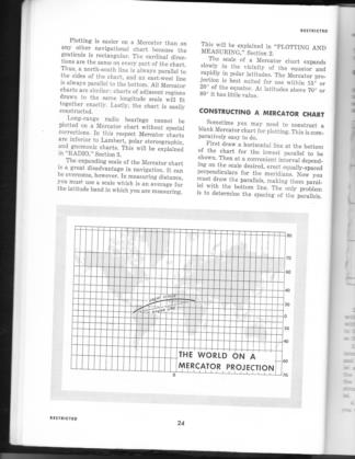
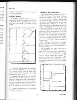
And U.S. Air Force Manual 51-40, "Flight Navigation" (1951) gives a method to construct a MERCATOR chart using the inverse of the other graphical methods. This method allows you to cover a greater range of latitude in that it keeps the meridians equally spaced and varies the parallels just like other Mercator charts that cover a greater latitude range. see attached.
The Air Force thinks it's a Mercator chart, the U.S. Navy Hydographic Office thinks it's a Mercator chart, Dutton thinks it's a Mercator chart and so do I.
gl


