NavList:
A Community Devoted to the Preservation and Practice of Celestial Navigation and Other Methods of Traditional Wayfinding
From: Mark Coady
Date: 2021 May 24, 10:55 -0700
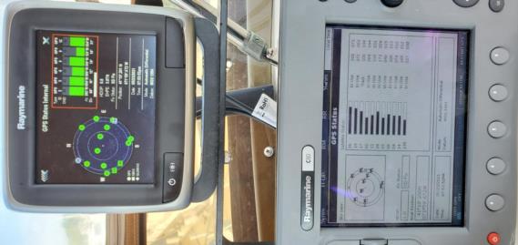
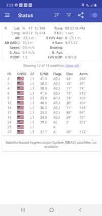
The attached .pdf compares 3 GPS simultaneous satellite data outputs (ok; cell is 4 sec later to allow time to screen cap after taking pic of bridge outputs). All were tracking similar Sat groups (pics).
1 is a Raytheon GPS on the bridge of M/V Syrena
2 is the Raytheon Radar system GPS from the bridge of M/V Syrena.
These two ship GPS have redundant antennas within a very few feet of each other.
The last GPS output is from a Samsung Android smartphone also operated from the bridge a few feet away at the exact same time to add more data.
The antenna/reciever location of the three are within a few feet, both altitude and surface locations, but the sat tracker Azimuth/Elevation output differences surprised me.
I expected that they would match closely and discrepancies would be small and very consistent.
Clearly they are rounded to whole numbers, but that does not account for the uneven degree-plus gaps.
I feel like I have my head in the oven and my feet in a bucket of ice water, but on the average I feel fine.
Captain Confused
M/V Syrena


