NavList:
A Community Devoted to the Preservation and Practice of Celestial Navigation and Other Methods of Traditional Wayfinding
Re: Timing Upper Limb Sunset by Camera
From: Bill B
Date: 2015 Mar 28, 17:01 -0400
From: Bill B
Date: 2015 Mar 28, 17:01 -0400
On 3/27/2015 8:46 PM, Greg Rudzinski wrote:
> I'm pretty sure you intended 34° 2.8' N to be the latitude rather than
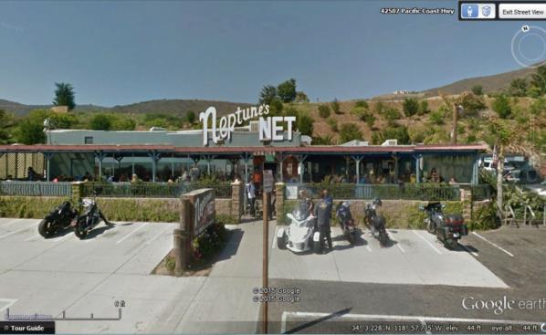
> 35° 2.8' N.  Now go to street view Google map to find the pub on PCH.
> The height of eye is only an estimate.

Yes and no. There was a comedy of errors and blunders in my
calculations. First and foremost doing it piecemeal until my poor
methodology took me down the rabbit hole.

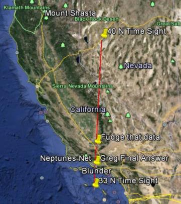
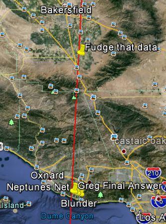
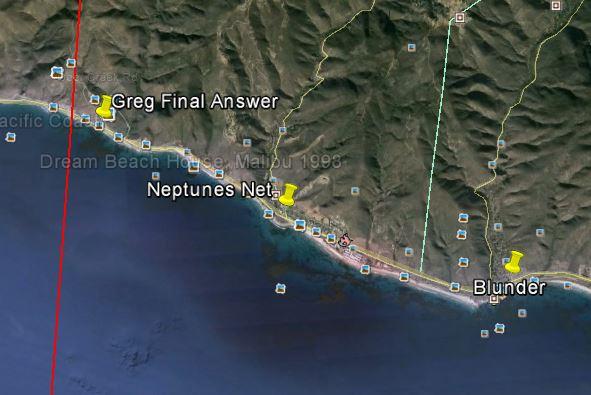
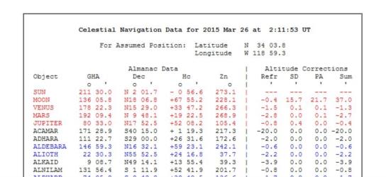
Final answer: 34d 03!8N 118d 59!3W (Greg data Final.JPG). Close?

I started on my screen porch as the sun was shining (although temps were
in the mid 20's) doing my initial time sights and calculations in the
margins and gutters of the sports page. Mistake #2, adding 49.8
refraction and 6.9 dip for a total of -58!8 instead of -56!7 for my
target Hc. That shifted the LOPs (and the spot to the SE) but the spot
was still around 34N and change.

I located the spot on Google Earth and checked that against the USNO
data for AP. It was a bit off, so I moved the cursor along the highway
around 34N and did a hunt and peck on the USNO site (aka fudging data)
until I was close to a match. (Greg data 1.JPG)

Introducing the next blunder. In some iteration I caught and corrected
for error #2 (target Hc) and continued to hunt and peck on the USNO site
to find a matching Hc.  Although the cursor was near 34N on the map, I
entered 35N in the USNO sight at some point and continued to do so.
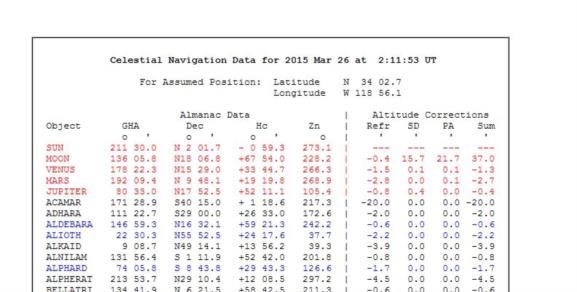
Upshot, 35d 02!8 N and 118d 56!7 fits and is near the time sights' LOP,
but nowhere near the coast. Like I said, by now I was well down the
rabbit hole. (Greg data blunder.JPG)

Brain dead, I posted and your reply brought me back to reality. Starting
fresh with my corrected LOP I did another hunt and peck, and 34d 03!8N
118d 59.3 is my final answer.

If, as some assert, the upper limb is extinguished by atmosphere so
cannot be viewed you may have been few seconds early on your call. That
would shift spot "by the numbers" north and/or west of you actual location.

I also checked elevation on my Delorme USA Topo program. As you've
probably been up the mast more than once, I trust your judgement on what
50 ft above the water looks like. But yes, a 10 ft change in elevation
could cause a mile or so difference in longitude, and larger distance
along a diagonal.

Thanks for a fun (mostly) exercise.
