NavList:
A Community Devoted to the Preservation and Practice of Celestial Navigation and Other Methods of Traditional Wayfinding
Re: Transcript Of Worsleys Navigational Log Book
From: Robin Stuart
Date: 2017 Feb 1, 12:53 -0800
From: Robin Stuart
Date: 2017 Feb 1, 12:53 -0800
Brad,
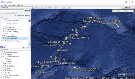
Just open both files together in Google Earth; File > Open in the menu. They'll appear in your "Temporary Places" (see attached image). From there you can choose which data sets to display and which not to by selecting individual items or directories. You can create your own directorties under "My Places" and copy whatever data you are interested in. You can inspect and/or edit the information associated with any item by right clicking it in the "Places" panel to the right or in the display and then selecting "Properties". It's all very standard and should be intuitive. I've done the mind-numbing bit of entering the data. You now have huge power and flexibility at your finger tips!
Regards,
Robin


