NavList:
A Community Devoted to the Preservation and Practice of Celestial Navigation and Other Methods of Traditional Wayfinding
From: David C
Date: 2017 Jan 23, 20:00 -0800
Some more........
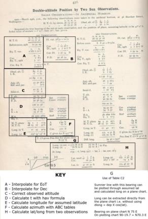
Whenever I have glaced at worked examples in old navigation textbooks I have been overwhelmed by how complicated it looked. After studying the Blackburne example I realise that it is quite easy provided you break the working into discrete chunks i.e. you apply structure to the calculations.
I have attached a marked up copy of Blackburne's calculations. What complicates things for 21st century eyes is the use of the EoT and the interpolation for dec and EoT, necessay because both are given for noon in the almanac. I believe that in 1925 (or was it 1929?) the factors R and E were introduced which would make examples even stranger to modern eyes. However it all makes sense (-;
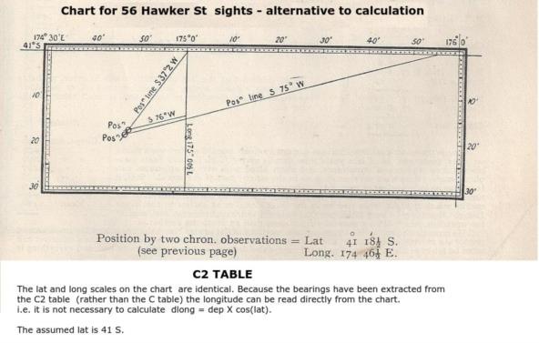
When working a sumner lat/long can be determined either by calculation (ABC tables) or by plotting.
There are three ways of plotting sumner lines:
- On a plotting chart (different lat/long scales). Long can be read directly.
- On a plane chart (identical x/y scales). Departure is read from the chart and dlong = dep X cos(lat) used to determine long.
- On a chart with identical lat/long scales. The position line bearing is obtained from Blackburne's C2 table (rather than the Sun's azimuth from table C). The long can be read directly from the chart.
This may be as far as I neeed to go. At the very least I think that I should take a break (-;


