NavList:
A Community Devoted to the Preservation and Practice of Celestial Navigation and Other Methods of Traditional Wayfinding
From: Frank Reed
Date: 2017 Jan 21, 11:25 -0800
John Howard, you wrote:
"When looking at your GPS to fix a place it is not the same datum as what was used back in 1902. Even today, if you stand on the line in front of the Greenwitch Observatory the GPS will not show zero longitude."
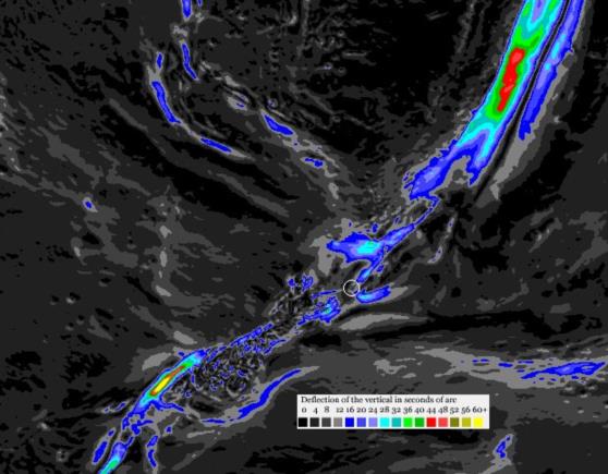
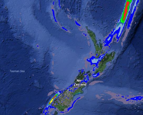
There are two issues in play: choice of datum, and, separately, astronomical versus geodetic latitude and longitude (note: I am possibly using the latter term in a non-standard way!). The datum is a pure mathematical ellipsoid to which geodetic latitudes and longitudes are referenced. There were different ellipsoids in use historically. With few exceptions, those have passed into history. Datum choice is not a concern for the case under consideration. Astronomical latitude and longitude still exist and will always exist, and they remain distinct from geometrically-defined geodetic latitude and longitude. The two systems are distinguished by the local gravitational "deflection of the vertical" caused by the irregular distribution of the Earth's mass at every scale. Fortunately for the practice of celestial navigation, this difference is rarely larger than one minute of arc, and it is now a known quantity which we can map with enough accuracy even for the most meticulous celestial navigation. But we cannot use celestial fixes or compare them with modern geodetic lats and lons ("GPS" coordinates, colloquially) unless we make allowances for the deflection of the vertical. In the images below, I have mapped the deflection of the vertical around New Zealand, both raw and in an overlay on a Google Earth image (roughly aligned by hand). As we can see, there are areas near New Zealand with substantial deflection of the vertical, but in the immediate vicinity of Wellington, the deflection is near zero, and therefore astronomical latitudes and longitudes can be directly compared with GPS latitudes and longitudes.
Frank Reed
ReedNavigation.com
Conanicut Island, New England


