NavList:
A Community Devoted to the Preservation and Practice of Celestial Navigation and Other Methods of Traditional Wayfinding



From: Patrick Twohy
Date: 2026 Jul 29, 16:33 -0700
Dave, Your idea of looking up the the best Hc fit in H.O. 229 was the key I needed. Thanks!
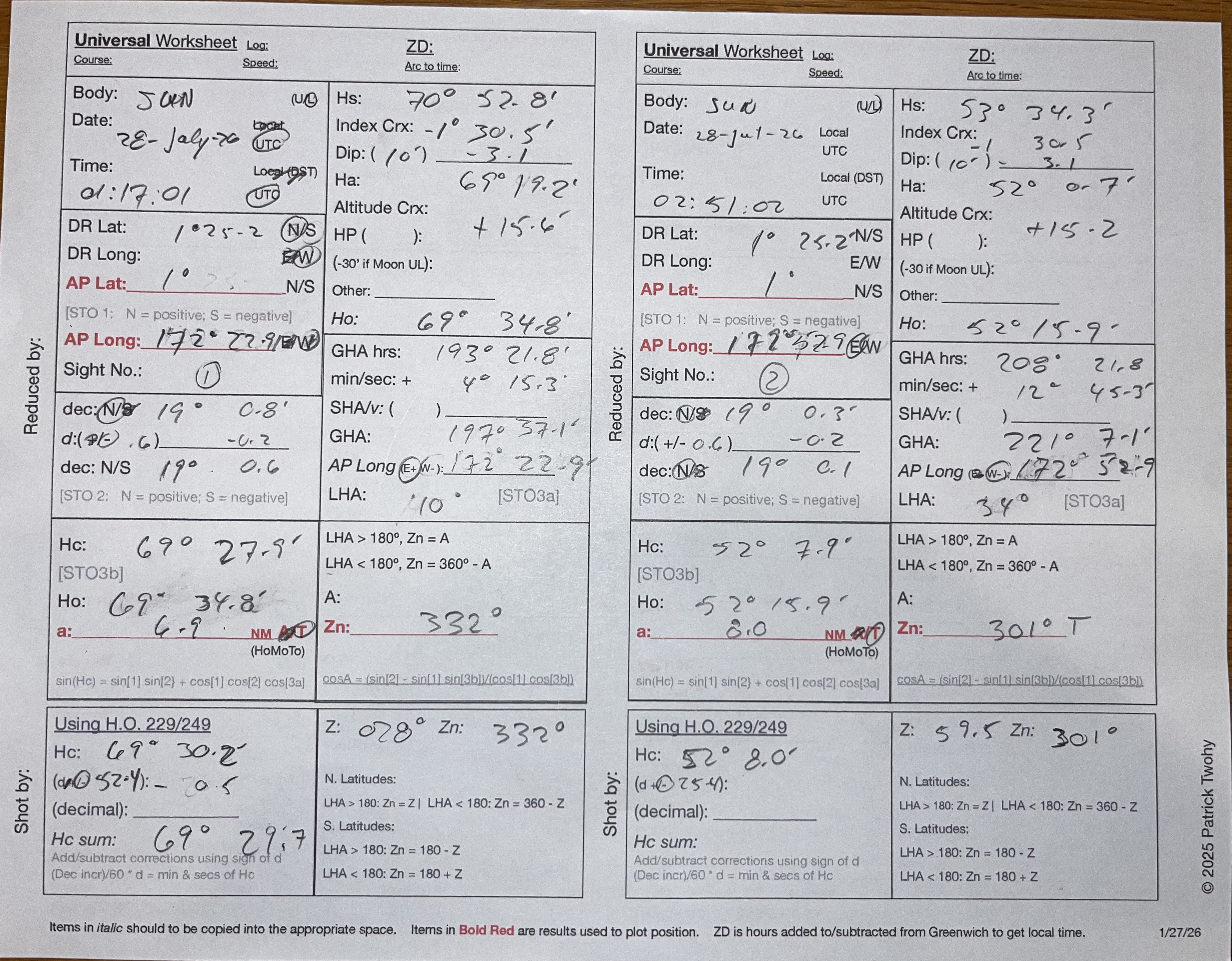
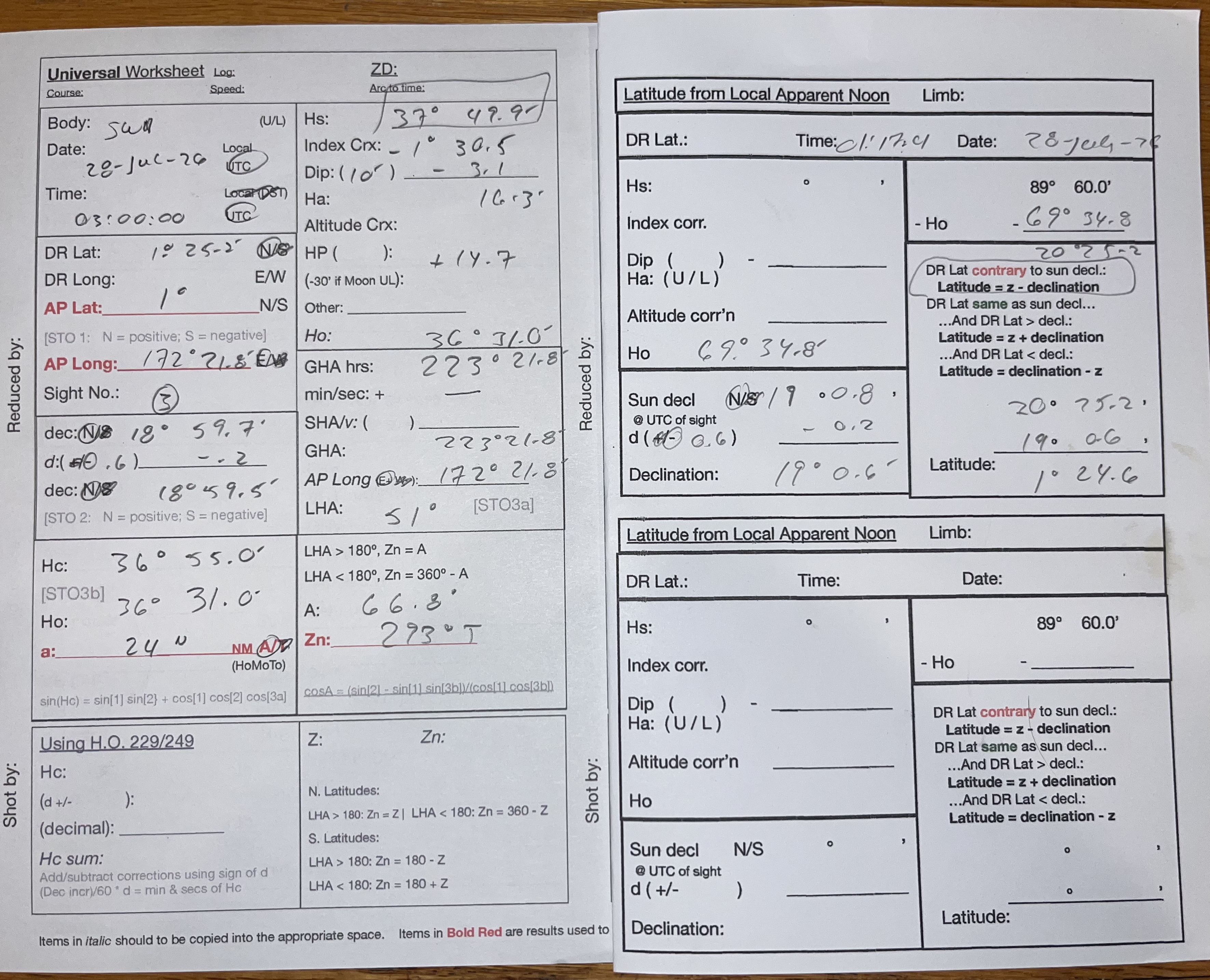
I ended up with something similar to you. And I agree we should show our work. I first worked backward on the original sun shot to get a DR latitude: 1° 25.2 N. Then, with your idea of find a LHA by working backward in H.O. 229, I found DR latitude in the 172° east range. (But, like you, I was thinking west longitude, so I was getting numbers like 187° west... doh.)
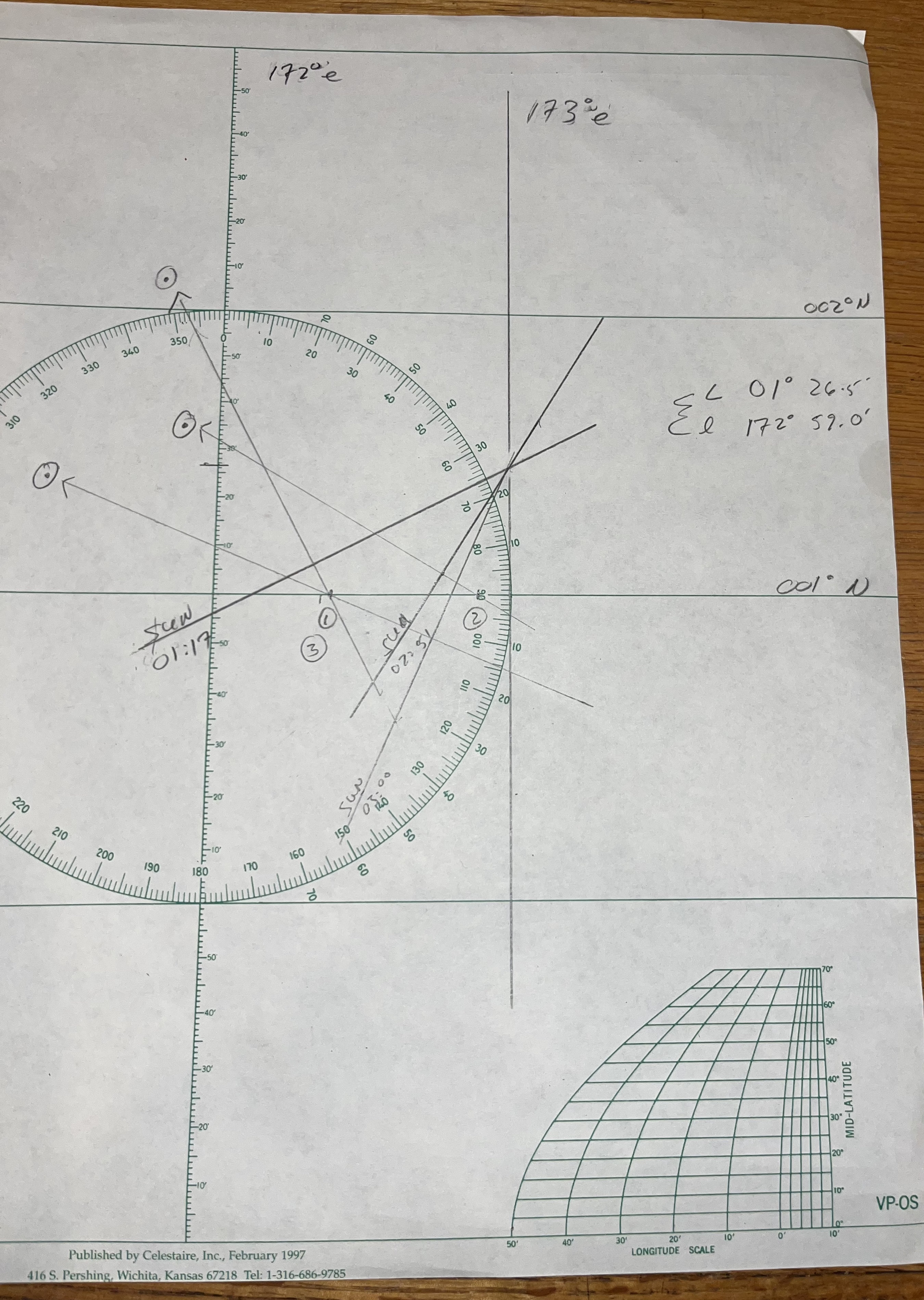
I did the sight reductions for both shots and got a "fix" at 001° 26.5' N 172° 59.0 E.
To solve Josh's REAL PUZZLE, I ran though the process of reducing the site as if it were 03:00:00 and plotted the result. I ran an LOP though the previous fix and found an intercept of 24 NM away. That gave me in Ho to work from. I noted that the altitude correction for that Ho was +14.7, so I subtracted that amount to get an Ha, and then added back the index and dip corrections to get an Hs of 37° 49.9'
Josh... Another fun exercise! Thanks!!