NavList:
A Community Devoted to the Preservation and Practice of Celestial Navigation and Other Methods of Traditional Wayfinding
From: Sean C
Date: 2012 Dec 19, 13:16 -0800
I recently found a "KML" (read 'plug-in') for Google Earth called "Range Rings for Google Earth", or simply "Rings". This KML allows you to define a central point via Lat/Lon coordinates and then to plot rings at a specified distance and interval from the center.
I found this KML because I was looking for something I could use to evaluate different locations nearby in terms of horizon distance. I wanted to have a range ring set at 5 nm that I could place anywhere on a map to evaluate different azimuths at each location.
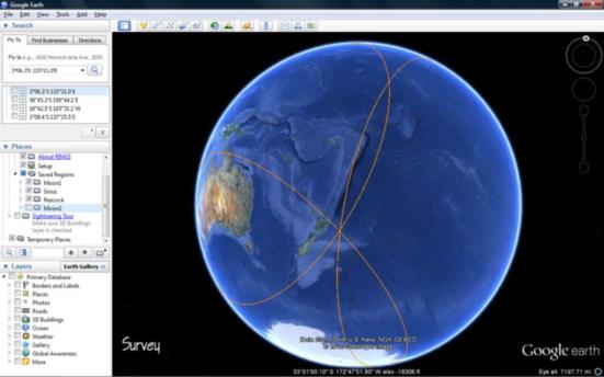
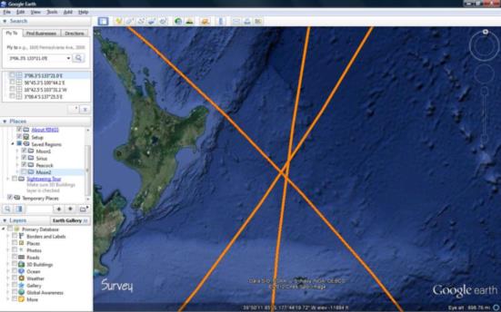
The KML is certainly useful for that. But it occurred to me that I could also use it to plot circles of equal altitude as well. I tried it with one of the examples from "100 Problems" and it worked pretty well. I used the G.P. of each body as the center and the zenith distance as the range. Although, I can't seem to get it to plot just a single ring. It seems to only plot ranges of rings, but that's no big deal. I may figure out how to get it to do what I want if I tinker with it some more.
The KML is available FREE here:
http://www.metzgerwillard.us/rings/rings.html
Just download it, open the folder you downloaded it to, right click and select open with...Google Earth.
The UI is less than stellar. For each new G.P. you have to refresh [ctrl+R] the settings so that the proper coordinates appear in the settings dialogue. You can't just type them in. (?) Maybe I can email the developers and make some suggestions. Anyway, attached are a couple of screenshots from my first test. Enjoy!
-Sean C
----------------------------------------------------------------
NavList message boards and member settings: www.navlist.net/NavList
Members may optionally receive posts by email.
To cancel email delivery, send a message to NoMail[at]navlist.net
----------------------------------------------------------------


