NavList:
A Community Devoted to the Preservation and Practice of Celestial Navigation and Other Methods of Traditional Wayfinding
Re: Fw: Grounding of cruiser PORT ROYAL
From: Frank Reed
Date: 2009 Jul 18, 06:25 -0700
From: Frank Reed
Date: 2009 Jul 18, 06:25 -0700
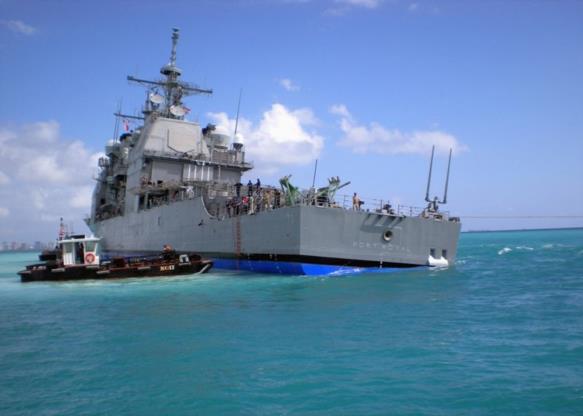
I've been looking at a couple of the photos of the Port Royal on the shoal
south of the airport. In one of them (attached), you can clearly see the
skyline of downtown Honolulu not far in the distance. The airport and its
main runway were just to port. This was a visually "busy" environment at
night with all sorts of airport lights, city lights, and the bright lights
from the sewage treatment plant and the vast port facilities dead ahead. It
got me wondering just what it would all have looked like from the bridge of
the vessel that night. And of course to find out, I needed to know just where
they were. This is where it gets fun...

I prowled around on the web for a while yesterday looking for photos of the
vessel on the reef from various angles. There are a couple of photos taken
from the tugs and salvage vessels nearby, and they offer some hints. There
are also a number of photos taken with the airport in the foreground, but
these don't seem to help much since that runway doesn't have many
identifiable features visible from ten feet above sea level. Then I found a
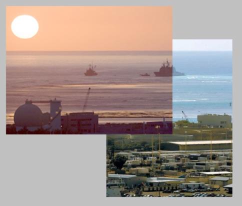
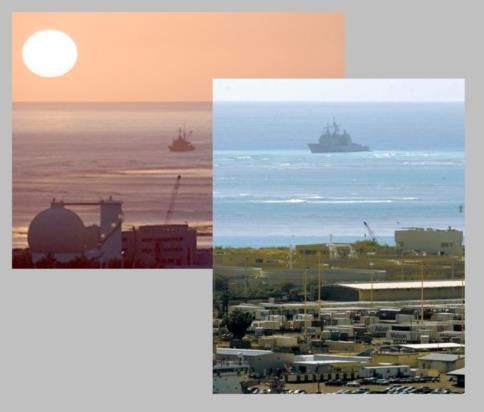
couple of photos taken with telephoto lenses apparently from tall buildings
in downtown Honolulu that are quite useful. I patched them together into a
couple of composites (also attached). And one of them, no doubt taken for its
artistic qualities, includes the setting sun! That gives us an angular scale
and a good estimate of azimuth. In the foreground of the daylight portion of
the image, you can see a bunch of containers all labeled "Matson". So go to
Google Maps and ask for "Matson Honolulu HI". That takes you right to their
big lot on Sand Island between the airport and downtown Honolulu. Line things
up just right, and we should be able to figure out just where the Port Royal
came to rest on the shoals on February 6, 2009. There's some entertaining
geometry and navigational calculations here. I won't spoil it by giving my
results. Besides I would like to see what some of you get independently. One
warning: the facilities at the Water Treatment Plant on Sand Island have been
significantly expanded since the last imagery was acquired for Google
Maps/Google Earth. That big egg-shaped structure is a "sludge digester" and
it's new. See if you can find the wind sock for the helipad (I think it's a
wind sock at least).

Some questions to ponder: what is the true bearing from that big circular
sewage tank in the mid-ground out to the Port Royal? Can you do a "dip short"
or similar to figure the distance to the vessel? Can you make a guess how
high the observer was who took the photo (assuming it was taken from the
central area of downtown Honolulu)? And finally, with all the available
evidence, what were the latitude and longitude of the Port Royal's bow and
stern while she was parked on that reef?

-FER

--~--~---------~--~----~------------~-------~--~----~
NavList message boards: www.navlist.net
Or post by email to: NavList@navlist.net
To , email NavList-@navlist.net
-~----------~----~----~----~------~----~------~--~---


