NavList:
A Community Devoted to the Preservation and Practice of Celestial Navigation and Other Methods of Traditional Wayfinding
From: Frank Reed
Date: 2018 May 3, 12:55 -0700
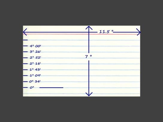
It's June 12, 2018. You are becalmed in the North Atlantic. You don't have a sextant or a Nautical Almanac, but you have a good wristwatch set to UT (GMT) and you have a calculator and some other basic items aboard (a rubber ball might come in handy here). So you make a paper sextant out of an index card (as in the image). You get the Sun's dec from the circle diagram I described a while back. You can estimate the Sun's GHA by knowing that the equation of time is near zero on this date (you knew that, right?). As the Sun is heading toward sunset, you measure its altitude above the sea horizon as 2° 30' +/-10'. The time on your watch is 22:19:30 GMT. Your height of eye is 10 feet (or 3 meters). And to make life a little easier, let's suppose that you have memorized an approximate refraction table and it's about 15' at this low altitude. Can you get a line of position from that sight? Suppose your latitude is 40.1° N, what is your longitude? Suppose your latitude is 40.2° N, what then is your longitude? Believe me, if you can do this with a paper sextant in the real world (yes, you can...), you'll impress the hell out of everybody on your vessel!
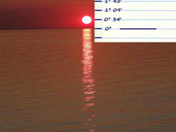
NOTE: the second image below illustrates how to use this paper sextant --assumed held at "arm's length", more specifically 25 inches from the eye, if this is a common US index card-- but it does not match the case described where the altitude is 2.5°)
Frank Reed


