NavList:
A Community Devoted to the Preservation and Practice of Celestial Navigation and Other Methods of Traditional Wayfinding
Re: Great Circle Sailing Chart
From: Gary LaPook
Date: 2016 Jan 15, 01:03 +0000
From: Robin Stuart <NoReply_Stuart@navlist.net>
To: garylapook@pacbell.net
Sent: Thursday, January 14, 2016 1:02 PM
Subject: [NavList] Great Circle Sailing Chart
Attached File:

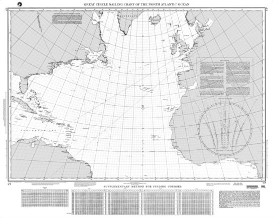
(nga_chart_17.jpg: Open and save)
From: Gary LaPook
Date: 2016 Jan 15, 01:03 +0000
I'm confused. The chart you posted is too small for me to read. You say that the diagram is for determining the "great circle bearing of the destination from the point of departure" but that is easily determined by measuring the initial great circle course at the nearest meridian printed on the chart to the departure. If it is determining the rhumb line bearing then it is apparently a graphical way of determining the "conversion angle," table 1 in Bowditch.
gl
From: Robin Stuart <NoReply_Stuart@navlist.net>
To: garylapook@pacbell.net
Sent: Thursday, January 14, 2016 1:02 PM
Subject: [NavList] Great Circle Sailing Chart
The NGA Chart 17 "Great Circle Sailing Chart of the Noth Atlantic Ocean" has a graphical device in its lower right hand corner for determining the great circle bearing of the destination from the point of departure. The instructions call for locating the point on the great circle (a straight line) at 5°, 20° or 30° longitude difference from the point of departure. This point and the point of departure are then located on a pair of curves in the diagram. A line drawn through the points gives the bearing. What are the principles by which this works?
Robin Stuart
Attached File:

(nga_chart_17.jpg: Open and save)


